LP Story Guide: The Alpine Loop
Originally published in Lonely Planet’s Epic Rides of The Americas in 2019
A spectacular scenic route along steep and rugged dirt roads over the high 12,000 ft (3,658 m) passes of the San Juan Mountains in Colorado. This one is a lung buster!
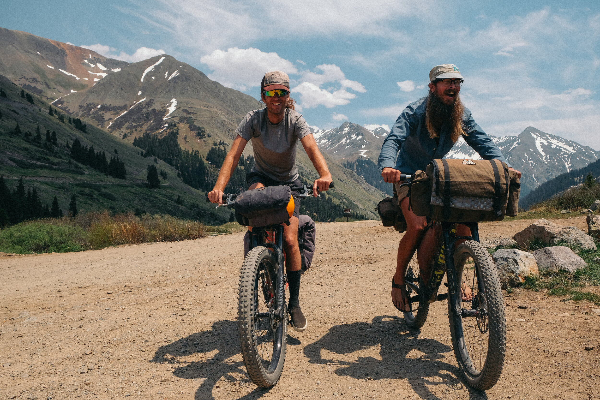
When a group of friends from Texas, Oregon, and Connecticut planned a trip to visit me in Colorado I couldn’t help but scheme the most impressive bike tour in the area I could take them on. I wanted them to get the most bang-for-their-buck, so I decided to take them on an epic journey over the high mountain passes and alpine tundra of the San Juan Mountains, following the Alpine Loop. The route makes a champion out of anyone who accomplishes the two lung-busting climbs above 12,000 ft (3,657 m).
Designated a Scenic and Historic Byway, The Alpine Loop circumnavigates 80-miles (129 km) through ghost towns and abandoned mines along mostly well maintained and gravel roads that become rockier and rugged toward the top of the passes. Due to the altitude of the mountain passes, the roads on this route are only open for a few months out of the year. Generally, the roads are clear of snow from July through September but in order to avoid the peak summer jeep crowds and catch the aspen trees at their full fall color, September is the most ideal time to enjoy the ride. While the distance is relatively short, the two major ascents on this route are slow going and can take the entire day to complete. Couple this with stops at the many historic markers it is best to allow 2-3 days to complete this route.
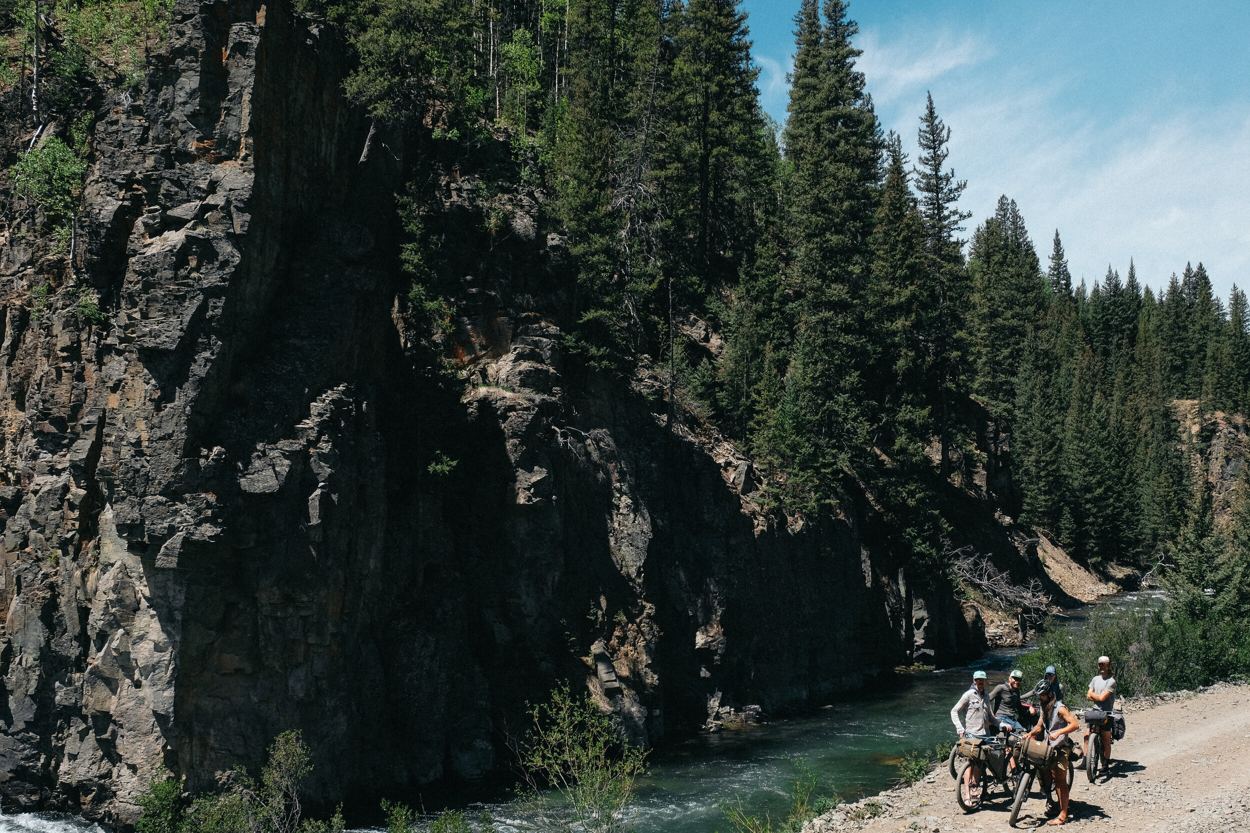
We began our ride in the historic mining town of Silverton, Colorado; nestled between 13,000 ft peaks it was at one point the hub of four major railroads serving the mining districts high into the mountains. This area was known to be one of the richest mining districts of silver and ore in the world, with much of the wealth of Wall Street around the turn of the 19th century coming from fortunes made here. Today, Silverton is a quiet town, a hub for adventures in the mountains, and tourists arriving by steam train from Durango along the historic Durango and Silverton Narrow Gauge Railroad.
Paralleling the paved road north of town we follow a quiet dirt road along the Animas River. At this point our altitude is 9,400 ft (2,865.12 M), the roads are smooth and the ascent is gradual. In Eureka the grade kicks up, separating our group as we settle into our individual climbing pace. We stop and regroup for lunch next to a waterfall. The wind and the mist from the falls are enough to cool us from the climb but are loud enough to require us to yell in order to converse, so we sit in silence and absorb our beautiful surroundings.
A few long miles later we arrive in the historic mining camp of Animas Forks where the mine structure and many old buildings still stand. Located at an elevation 11,160 ft. (3,402 M) Animas Forks was known for the publication of the highest printed newspaper, The Animas Forks Pioneer and was a bustling mining town of 450 people in the mid 1880’s. We explored the old building of Animas Forks, imagining what it would be like to live so simply, so high, day after day.
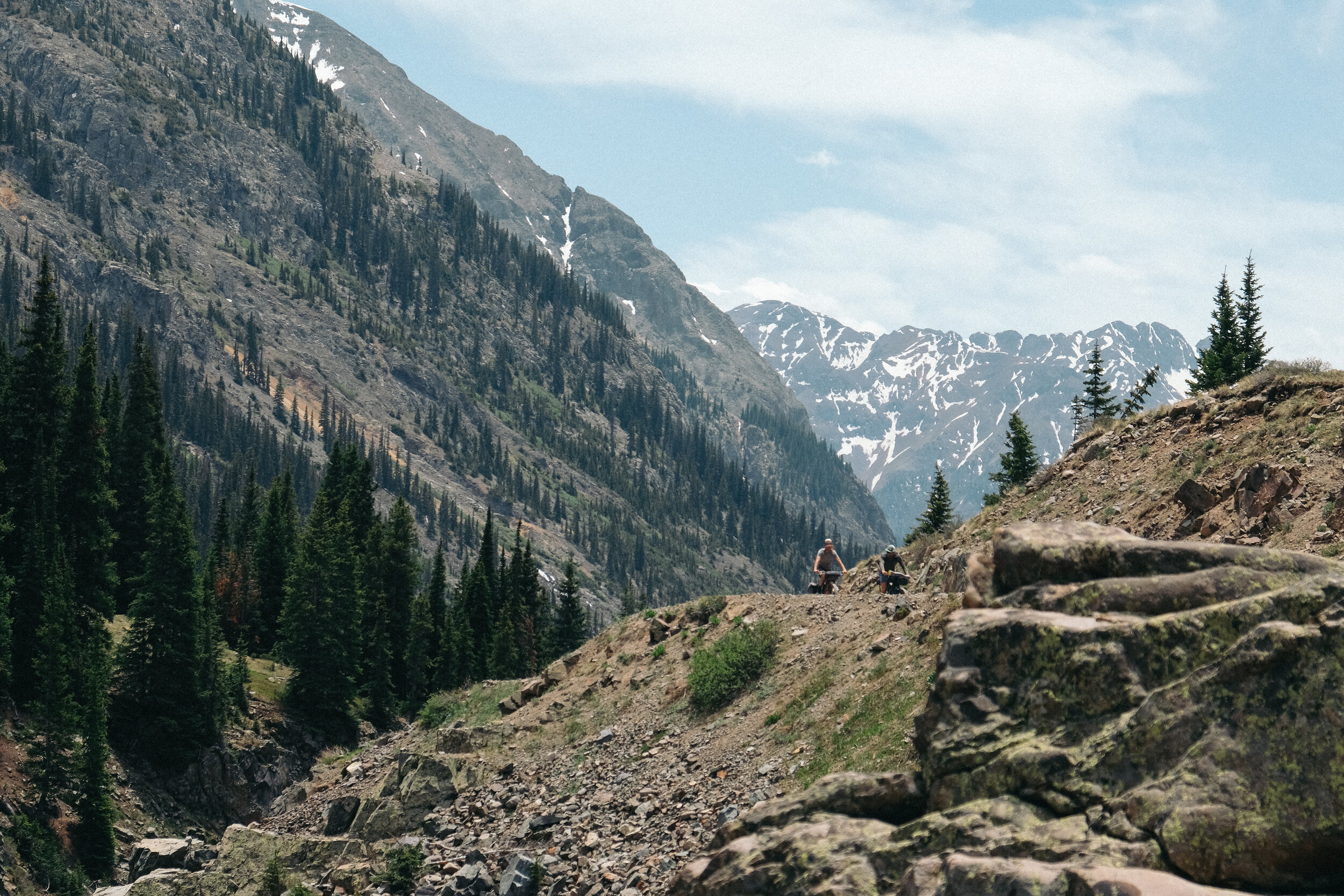
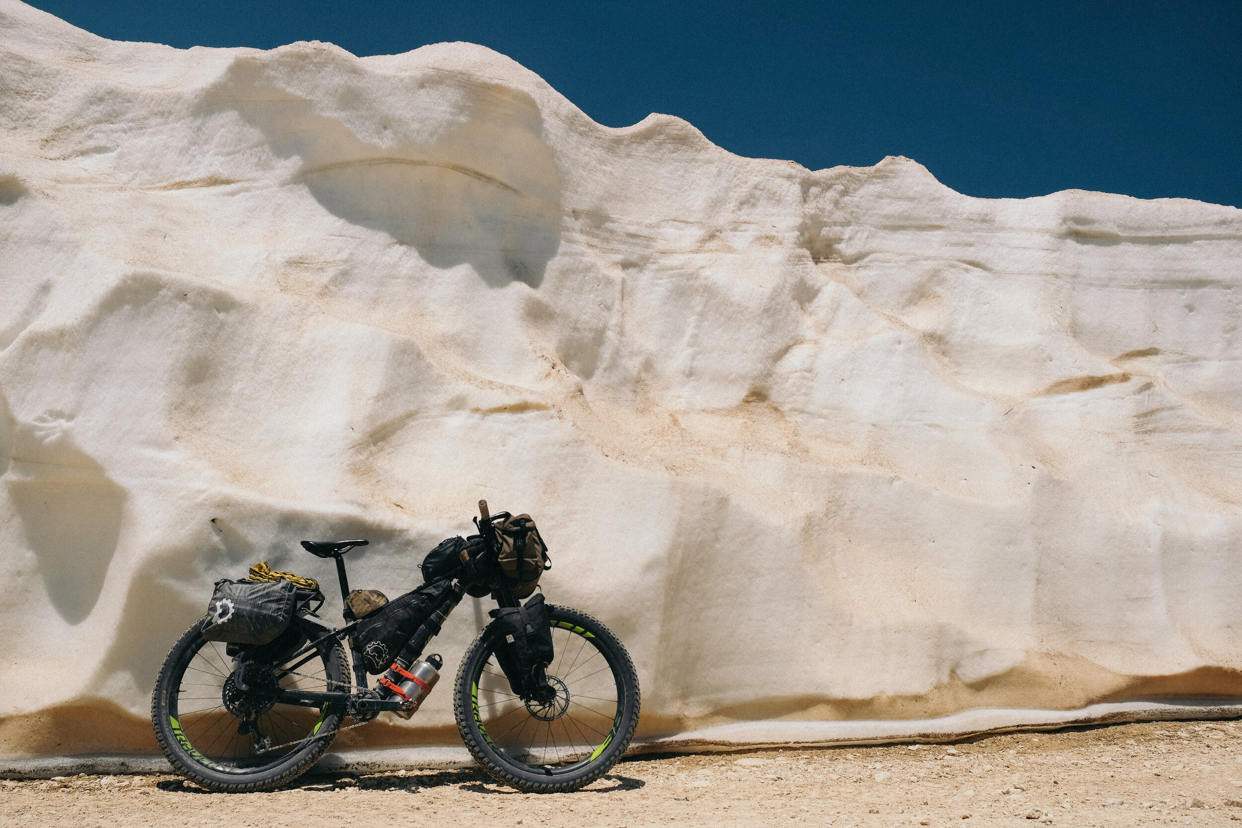
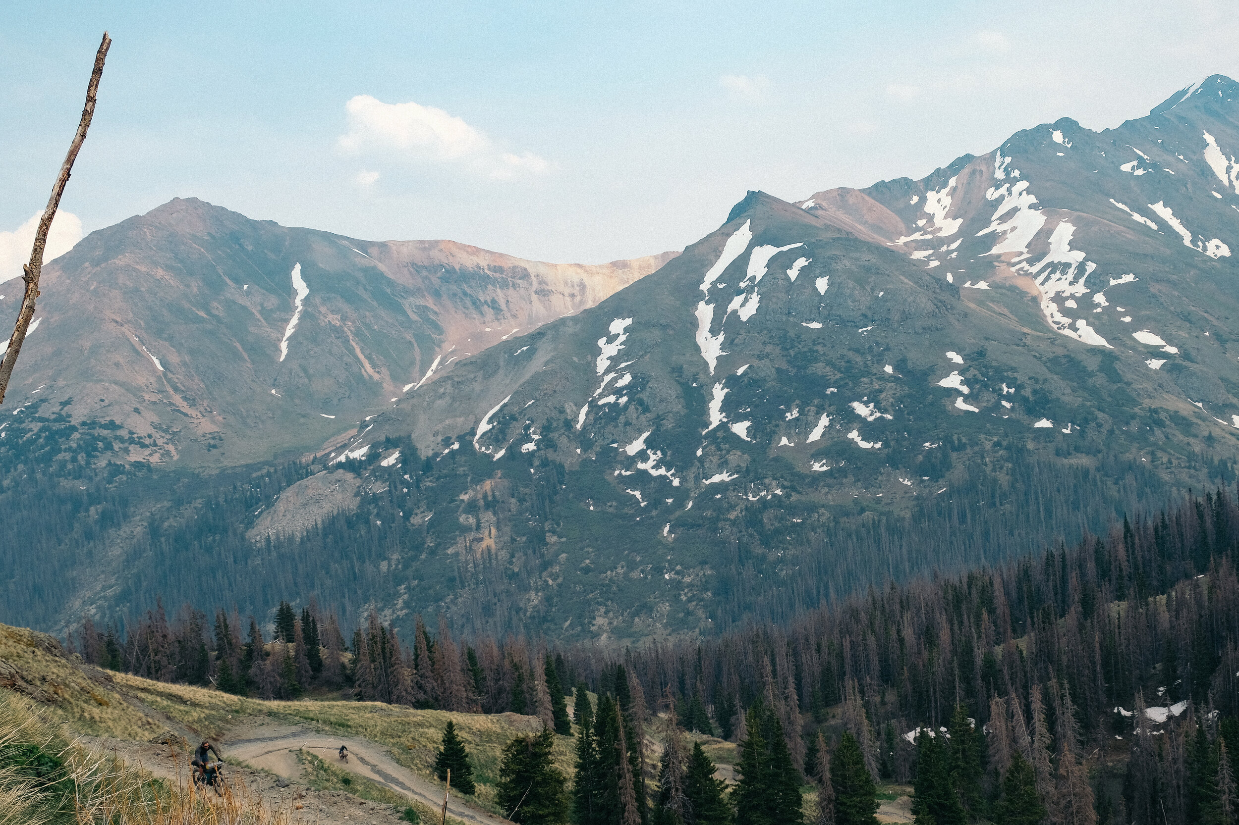
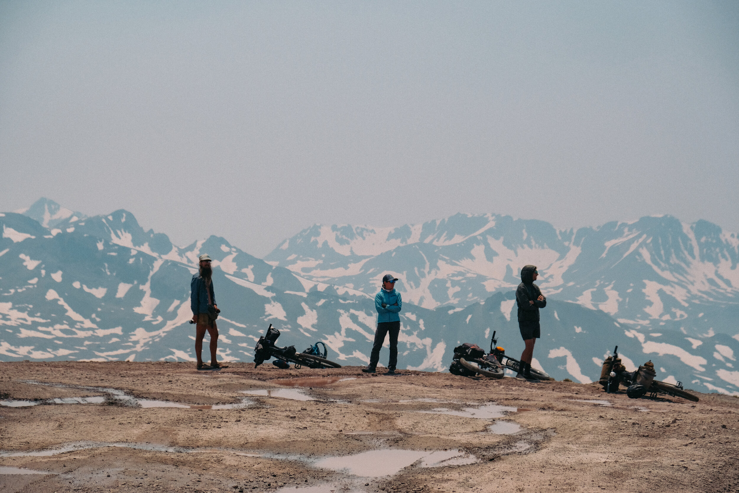
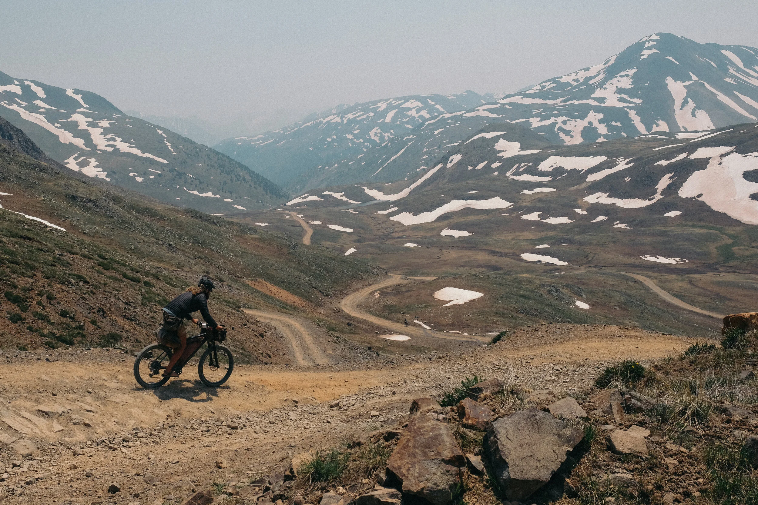
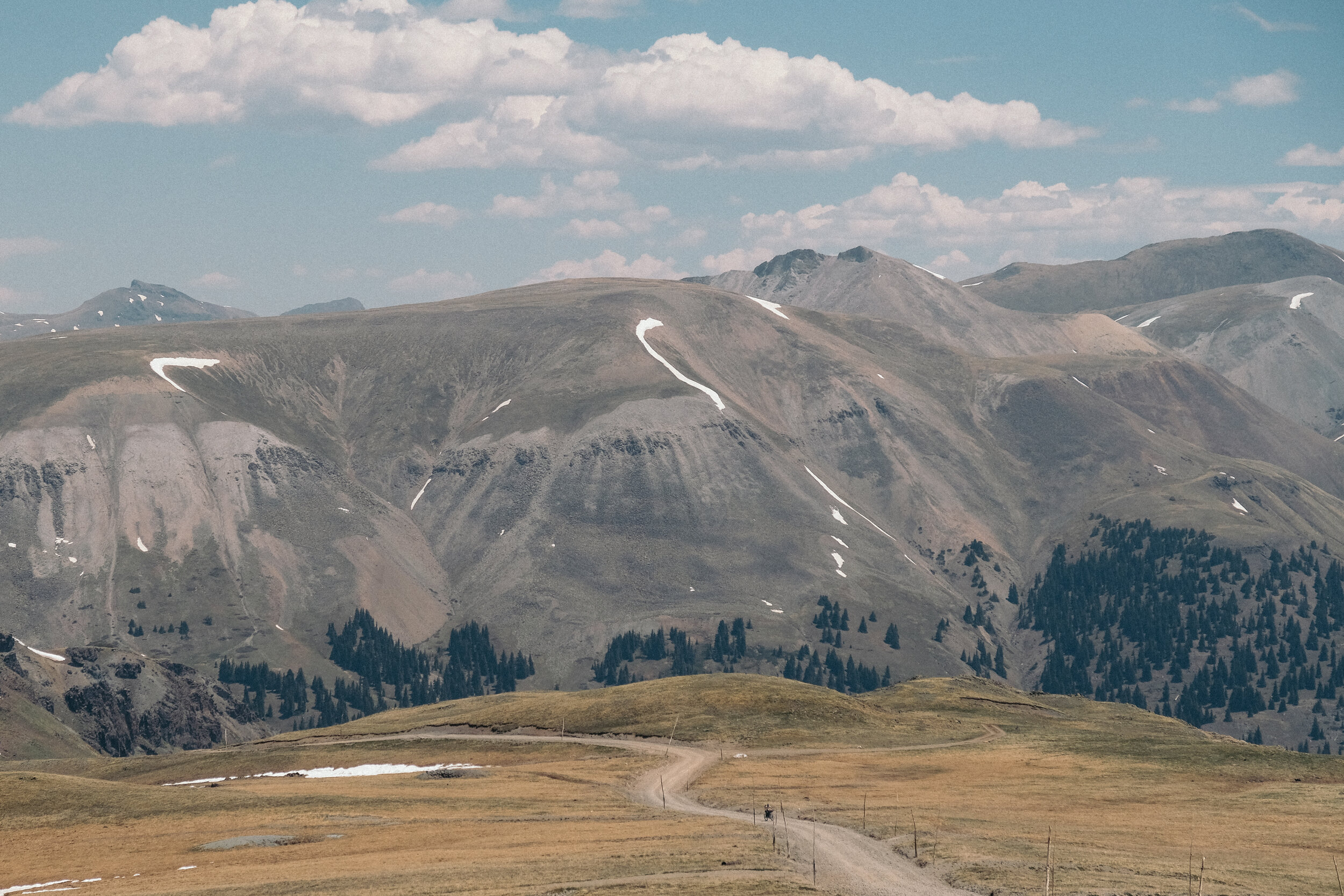
From Animas Forks the road steepens and becomes more rugged. At this point the altitude combined with the physicality required by the road surface has everyone in suffer mode. We may have enjoyed the views earlier in the day but now all we can focus on is the road in front of us while carefully balancing our bikes for traction over the steep loose rocks. Occasionally traction is lost forcing a welcomed break to look around. The views are incredible, out from tree line we can see for miles both from where we came, to where we are going. Alpine tundra is an otherworldly landscape dotted with large packs of snow creating ice-cold creeks dividing the land. We’re here during wildflower season and the tundra is sprinkled in red, purple, white and yellow. The moment of lost traction turns into a moment of piece and serenity and I stop to take a picture. I watch while my friends implement the strategy of alternating between riding and hike-a-biking. Due to the lack of oxygen, I can’t tell which one is harder. We reach Cinnamon Pass located at an impressive altitude of 12,600 ft. (3,840 m) and cheer for our remaining cohorts making the last push over the top. While we revel in the accomplishment of reaching such a high place by bicycle, we don’t linger. It’s cold and windy at the top allowing the sweat we generated on the climb to cool our cores. The reward occurs in the descent, which offers new views and valleys to explore. We’ve just dropped into American Basin, an alpine valley famous for its wildflowers in midsummer and they did not disappoint. We set camp, iced our sore legs in the creek, and went to bed early to the sound of water trickling by.
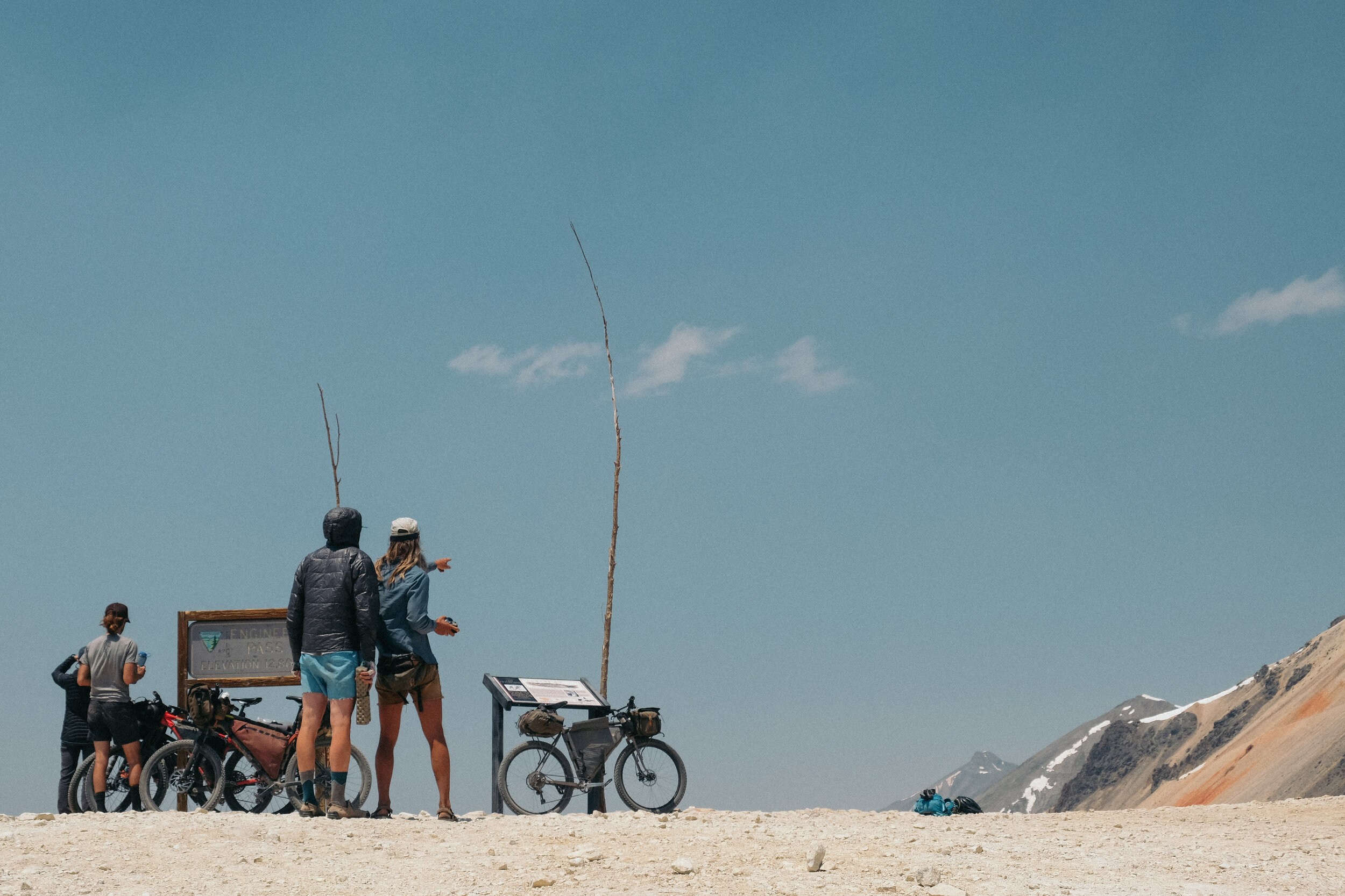
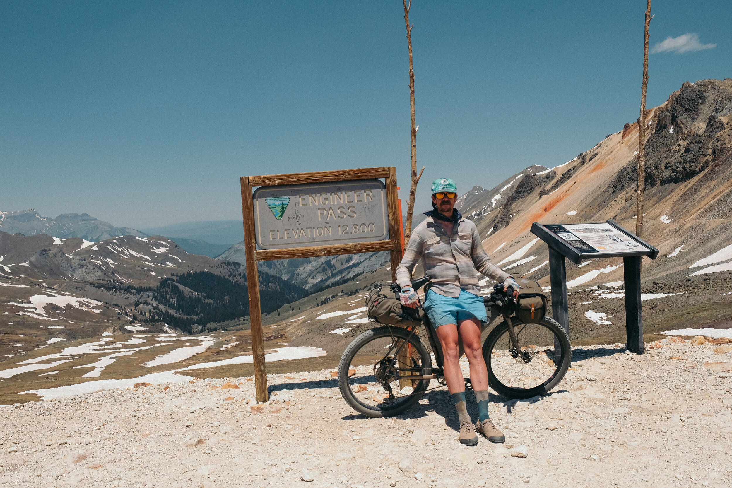
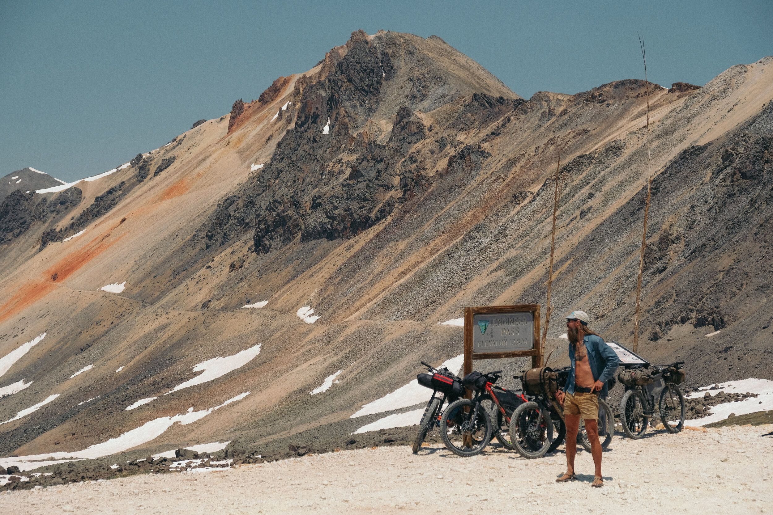
From American Basin the Alpine Loop drops down to Lake City at an elevation of 8,671 ft. (2,643 m) a small town equipped with all the trimmings for resupply and recovery. The Alpine Loop continues with another long climb to Engineer Pass that grows steeper and more rugged toward the top of the pass while passing vestiges of Colorado’s mining history and magnificent views of the impressive 14,000 ft (4,267 m) peaks characteristic of the San Juan Mountains. A long technical descent from the top of the 12,800 ft (3,901 m) Engineer Pass drops us back into Silverton, the perfect place for a celebratory drink at an old-time saloon.
Note
At the high elevations along this route, sudden storms can bring rain or snow at any time of year so make sure to bring some extra clothing in case of sudden drops of temperature. Summer monsoons bring afternoon storms from July through August. Plan the timing of your ascents, know your limits, and avoid camping above tree line.
Details
Start / Silverton, Colorado
End / Silverton, Colorado
Distance / 80 Miles (129 KM)
Getting There / The closest airport is the Durango La Plata County Airport. From there it is best to rent a car to make the hour and a half drive to Silverton.
Where to stay / The Raven’s Rest Hostel in Lake City. There are also many idyllic camping spots along this route between 10,000–9,000 ft. (3,048 – 2,743 M)
Best time of year to ride / July through September
Route GPX https:// https://ridewithgps.com/routes/13533093
For more information on this route visit, www.bikepacking.com
What To Bring / GPS device, water filter, camping equipment, cookware, clothes for the drastic change in temperatures, repair kit, spare tubes, a battery charger, your climbing legs, and a camera!
What type of bike / A bicycle with at least 2 inch (50 mm) tires is best used for this route.