LP Story Guide: Oregon Backcountry Explorer Route
Originally published in Lonely Planet’s Epic Rides of The Americas in 2019
This is a journey through time exploring the old-growth forests and the geologic wonderland of Central Oregon. Just watch out for goat head thorns!
Psssssss, “there goes another one!” It was our 8th flat of the day within a short 5-mile (8 km) stretch of dirt road along the John Day River. A brief moment spent off-track to explore the remnants of a ghost town resulted in a plague of goat head thorns wreaking havoc on the tubes and tires of my group. We made it 12 miles (19 km) total that day and limped our way to the closest town where we were pleasantly surprised by the refuge of an inviting bicycle traveler’s hostel equipped with tools, a pump, sealant, and all the comforts of home for a proper recovery.
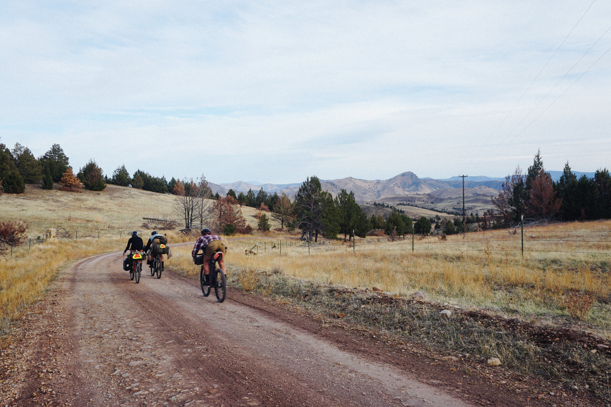
We were riding the Central Oregon Backcountry Explorer route as a short escape from the moody and rainy fall days of the city of Portland. Sitting in the rain shadow east of the Cascade Mountains, Central Oregon has an arid high desert climate offering a warm and dry environment within reach of a 3-hour drive from the city. This 152-mile (245 km) route follows paved and gravel roads as the landscape transforms from the grass meadows and old-growth ponderosa pine forests of the Ochoco Mountains to the geologic oddities of the juniper foothills of the John Day River Basin, while passing ranches and vestiges of ghost towns and mines.
The route begins in a town called Prineville. In a period when the presence of a railroad meant the difference between prosperity and fate as an abandoned settlement, the citizens of Prineville built their own railway to combat the inevitable. The railway supported the timber industry, and a town of 10,000 residents still exists today. The same cannot be said for the rest of the towns established in this region at the turn of the nineteenth century.
Before we start our ride I stop into the grocery store to pick up a few last-minute snacks. As I check out at the counter the clerk inquires as to where I’m headed. “The Ochocos” I say and eerily he responds, “Watch out for cougars up there. You can’t see them, but they can see you.” I don’t mention the exchange to my three friends but as we climbed our way through the dense dark forests of the Ochoco Mountains I couldn’t help but take a closer look at my surroundings for a chance to catch a stalking cat. Cougars aren’t the only wildlife to roam this land. This region is home to the hardy with an impressive variety of bird species, reptiles, pronghorn antelope, mule deer, and at times, elk.
At the top of the climb the pavement turns to dirt, and the road drops us into the John Day River Basin, an uplifted and eroded volcanic landscape formed by lava over 225 million years ago. Along the descent, a change in climate and scenery occurs. During this geographic transition, shady ponderosa pine forests gave way to an exposed deserted land of conical hills speckled with sagebrush and juniper trees.
We stop for a picnic of peanut butter sandwiches at the dilapidated ghost town of Horsehaven a town established after an ore of mercury was discovered in the surrounding hills in 1933. After burning down, being rebuilt, and collapsing again, the town called it quits by 1958 and historic structures still remain, scattered throughout the hills.
Through a corridor of lava rock, the John Day River emerges. Named after an expedition hunter and trapper from the early 1800s, John Day was robbed and stripped naked by Native Americans at the mouth of the river and forced to hike 80-miles to find some clothes. Today, the John Day River is one of the longest undammed, free-flowing rivers in the U.S. furnishing a diverse habitat for wild Steelhead trout, Chinook salmon, and many other species of fish. It is within this beautiful setting where our group noticed the consequence of our idyllic picnic location. We had three flats out of our group of four, and one on its way. The perpetrator, dried fruit from an invasive weed bearing hard sharp spines that is prevalent in this climate. Well known and feared by bicyclists, these spinning fruits are called goat heads for their familiar features. Multiple tubes were replaced, patched, and patched again.
We limped our way to the Painted Hills stunned by the turn of events that had caused us so much time of the day. The visit to the national monument put that time in perspective, as the geology revealed the change from tropical to temperate climate over millennia through red and yellow stained ribbons across its ancient mounds of shale.
By dusk, we reached the historic pioneer town of Mitchell. Seemingly unchanged by time the charming town offers camping in the town park, a general store, a brewery, and a bicycle tourist hostel. Located on the Trans America Trail (the paved cross-country route from Astoria, Oregon to Yorktown, Virginia) the donation-based, Spoken Hostel is built within a church and offers memory foam beds, showers, laundry, and a fun and friendly atmosphere to share tales of woe with fellow bicycle travelers.
Refreshed and resupplied, we leave Mitchell the following morning and climb our way back over the Ochoco Mountains along a rewarding climb for the effort. Through prairies and forests, we spotted a bald eagle perched on a geologic oddity and wild horses. We soaked up the vista of central Oregon and marveled at the adventure we had then descended back to where it started. Filled with wanderlust to return for more, we drove back to rainy Portland where we celebrated our record-breaking 12-flat fixes over some hefty burritos.
Note
In the 1980s this region was home to the city of Rajneeshpuram, a controversial commune home to 7,000 followers of the Indian mystic, Bhagwan Shree Rajneesh (Osho). Known for their free love ideology the Rajneesh grew controversial within the local communities for their attempts to grow and politically take over the nearby town of Antelope as well as the county seat of the Dalles and for a deliberate food poisoning attack of hundreds calculated to influence the election. A documentary called, Wild Wild Country outlines the historic controversy that occurred in the rocky hills along this route.
Details
Start / Prineville, Oregon
End / Prineville, Oregon
Distance /152 Miles (245 km)
Getting There / Redmond Municipal Airport [19.5 miles (31 km) away], Portland (3-hour drive), and Bend (50-minute drive).
Where to stay / Spoken Hostel in Mitchell and camping on public lands.
Best time of year to ride / June through October.
Route GPX / https://ridewithgps.com/routes/18196171
For the most up-to-date information and route versions of the route visit, http://www.bikepacking.com/routes/central-oregon-backcountry-explorer/
What To Bring / GPS device, plenty of water storage and filter, camping equipment, cookware, clothes for the change in elevation, repair kit, extra tire sealant, spare tubes, and a spare battery pack.
What type of bike / A bicycle with at least 38 mm wide tubeless tires is best used for this route.
More Routes like This
3. Craters and Cinder Cone Loop