Story Guide: The Ausangate Circuit, Peru
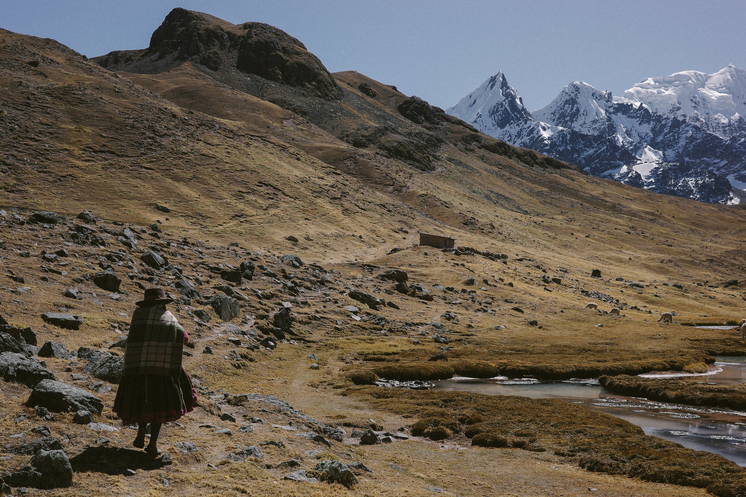
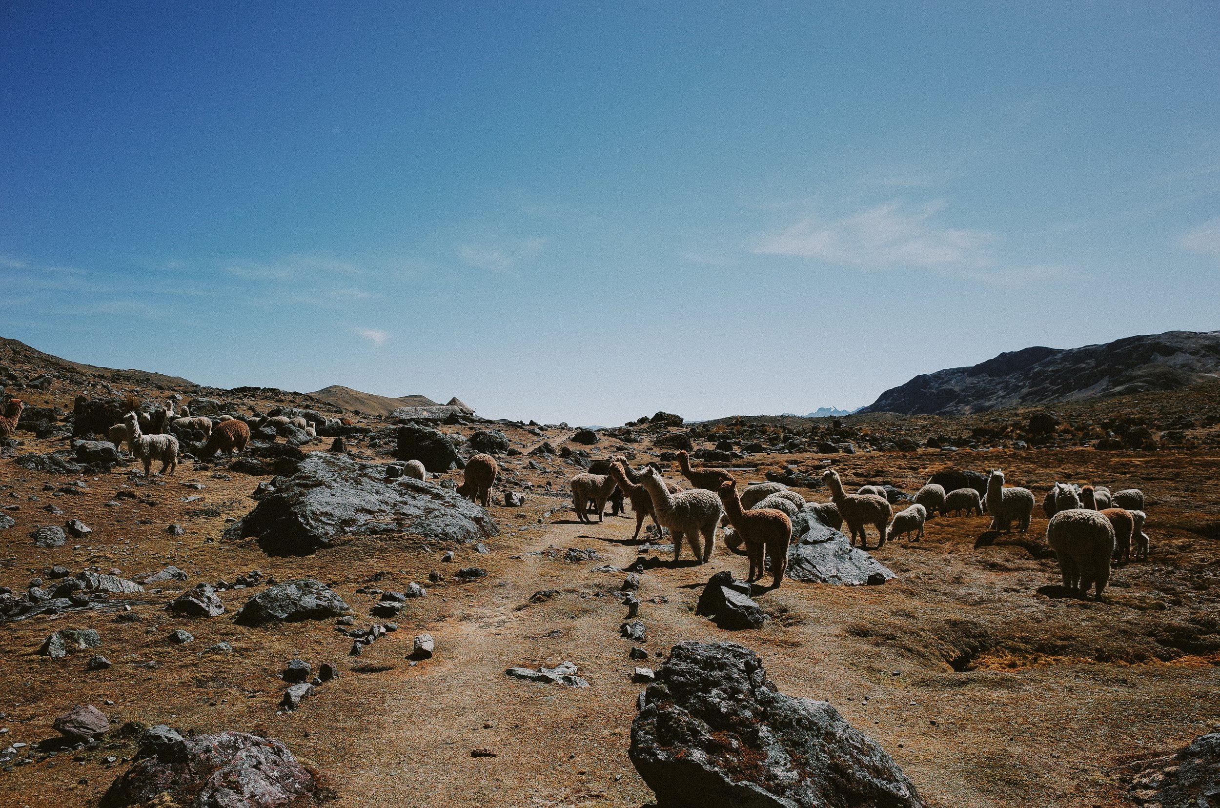

Situated 100 miles Southeast of Cusco, Peru, is Nevado Ausangate, a sacred mountain in the Peruvian Andes protruding 20,905 ft in altitude. Circumnavigating this jagged glacial-covered mountain is a historic trail system used for trading by one of the few remaining pastoral societies in the world. The Quechua people, who call the high tundras and river valleys at the base of Ausangate home, sustain their cultural way of life by living off the land, herding alpacas, weaving, and farming potatoes, and trading via trail systems with villages at lower elevations.
The trail system around Ausangate is well known among the hiking community and draws hundreds, if not thousands, of trekkers worldwide. Some opt for a more supported experience with guides and mules portaging their equipment, and other adventurous souls complete the route in a self-supported fashion.
The Ausangate Circuit has been on my radar and bucket list since I started visiting Peru in 2019. Route guides and stories by Cass Gilbert, Ryan Wilson, Mark, and Hannah Watson describe a demanding ride around the mountain with stunning views. My desire to ride in such an otherworldly landscape muted the reality of long hike-a-bikes at high altitudes. Still, it took doing two month-long dirt road tours in Peru for me to work up the courage to take on the Ausangate Circuit.
My partner Adam and I started our ride in La Paz, Bolivia, with the plan to follow the Ruta del Las Tres Cordilleras from Bolivia to Peru and end our tour with the Ausangate Circuit. However, after some figurative and literal roadblocks, which included: not being able to secure the post-dated visa exit stamp the route requires, having to navigate a series of landslides that eventually became too dangerous to continue forward, and both of us ultimately developing Covid symptoms, we decided to abandon our plan and re-evaluate the entire trip. After we sat out our symptoms quarantined in a hotel, we decided to give our recovering bodies more of a break from the high altitudes by traveling down to the Amazon. We spent a week in an eco-lodge in a small village deep in the Amazon, hiking through and learning about the rainforest and all it provides and birding to our hearts' content. When we returned to Cusco, we spent a couple of days riding mountain bike trails just outside the city limits, then felt good enough to start the Ausangate Circuit.
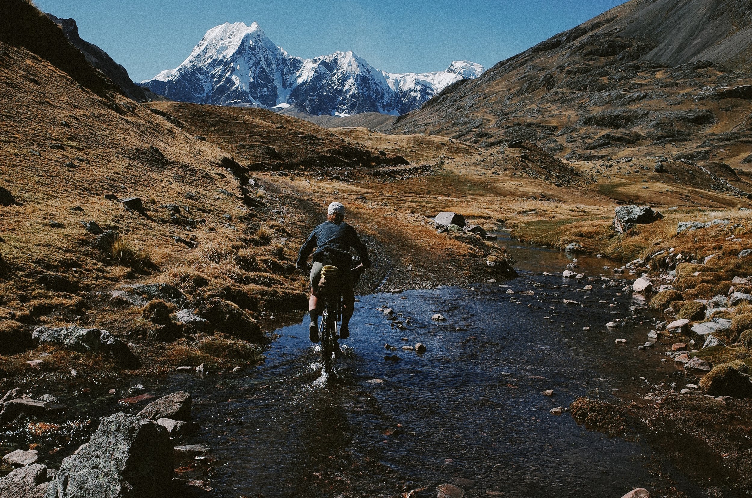
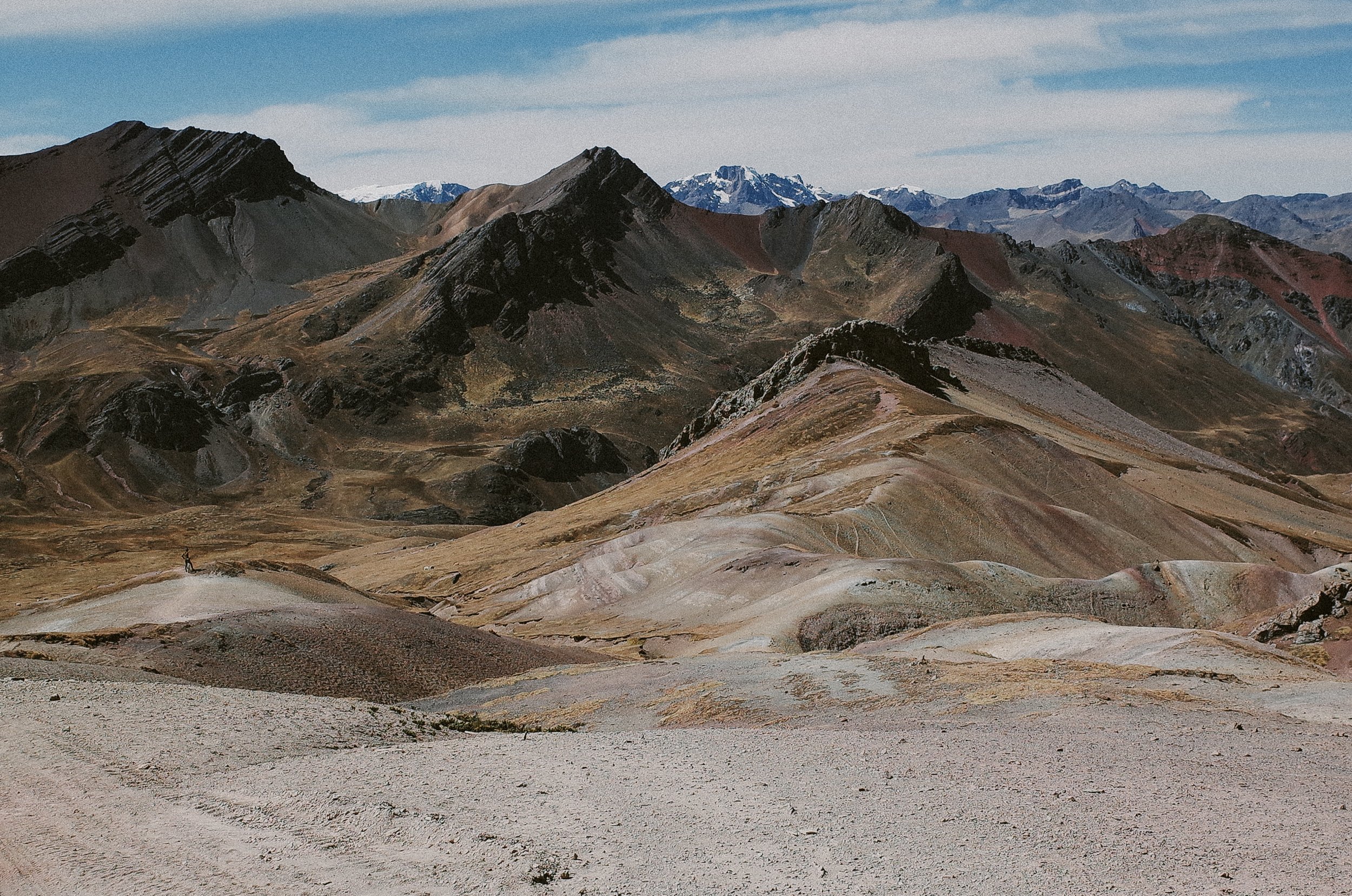
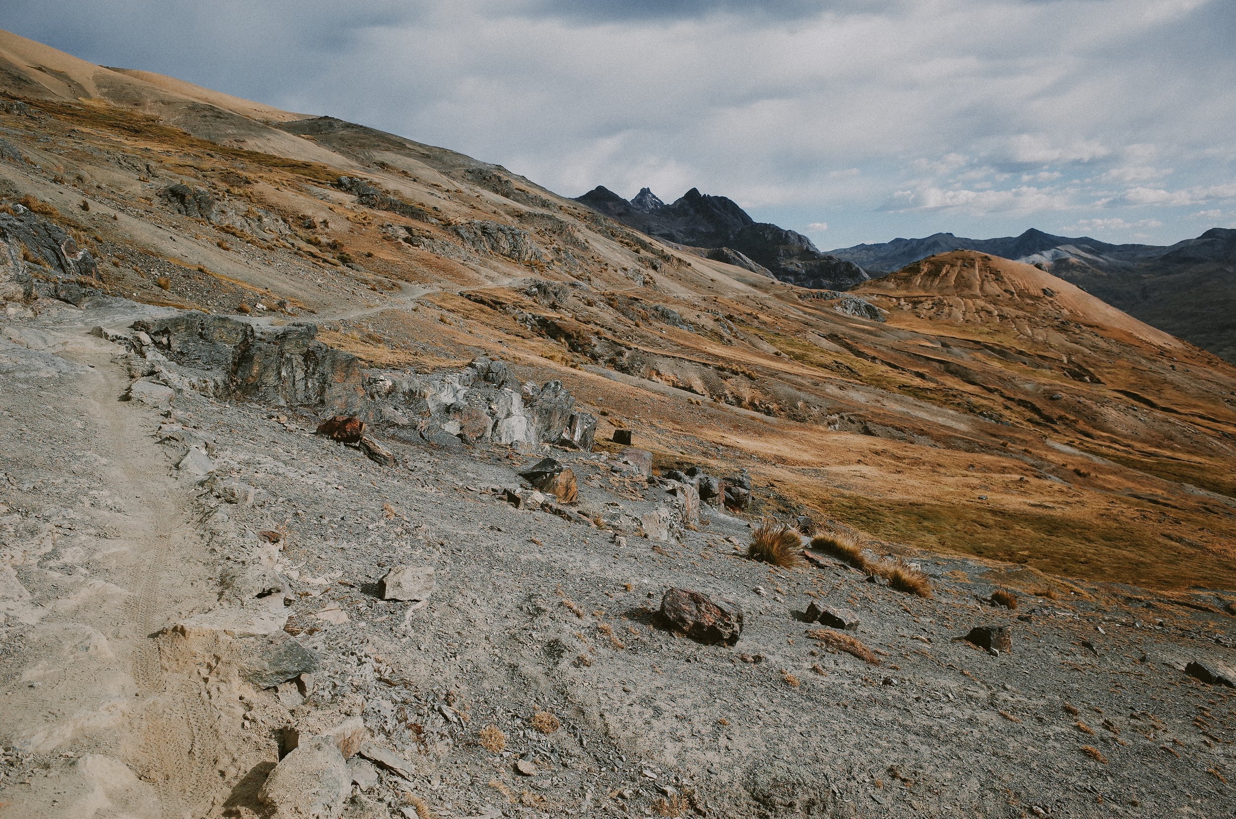
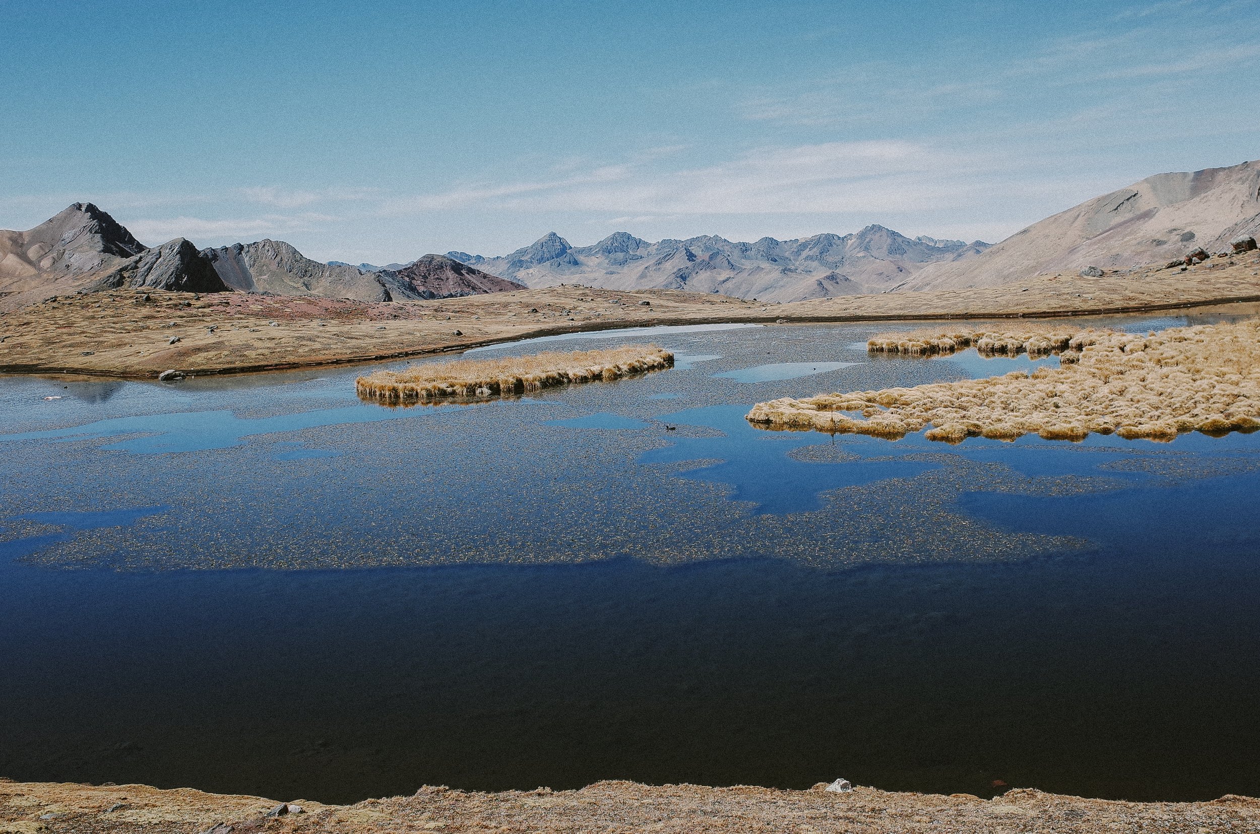
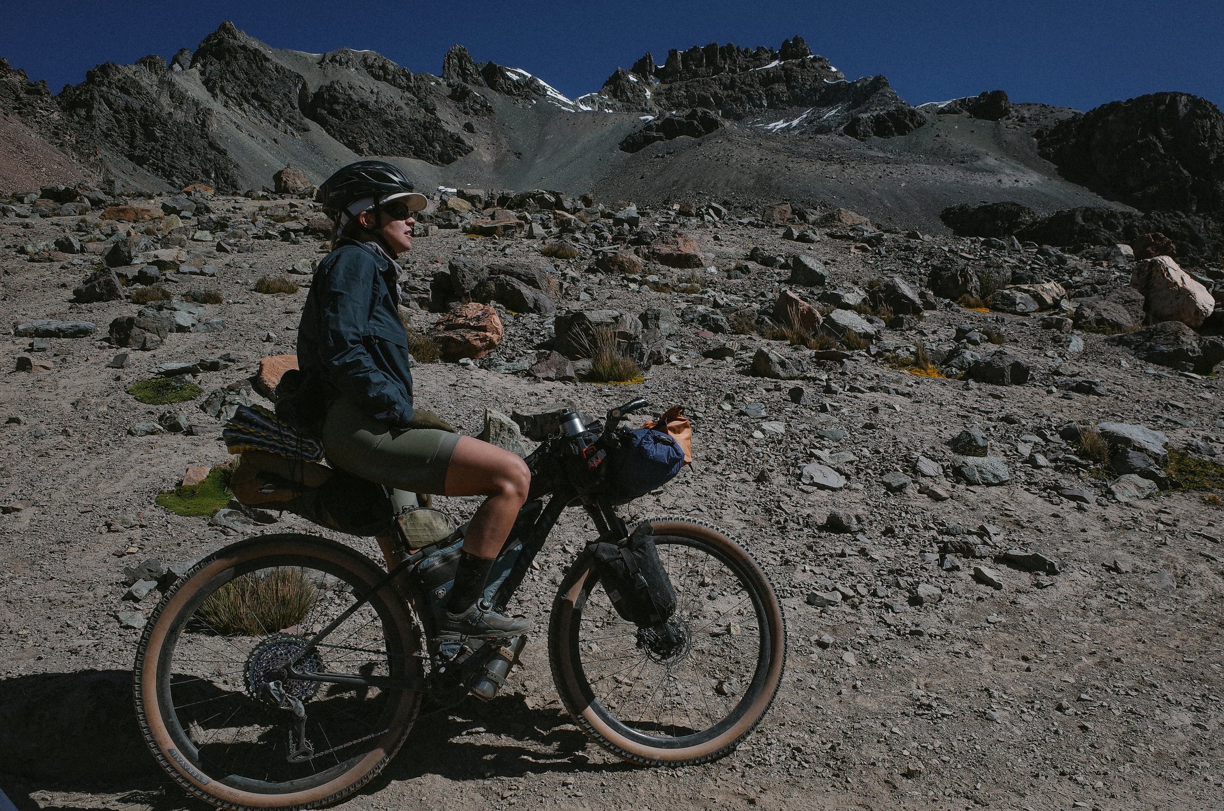
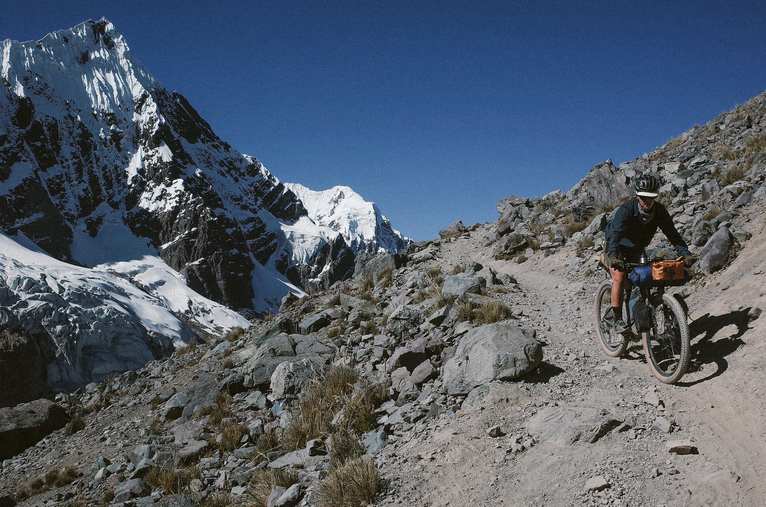
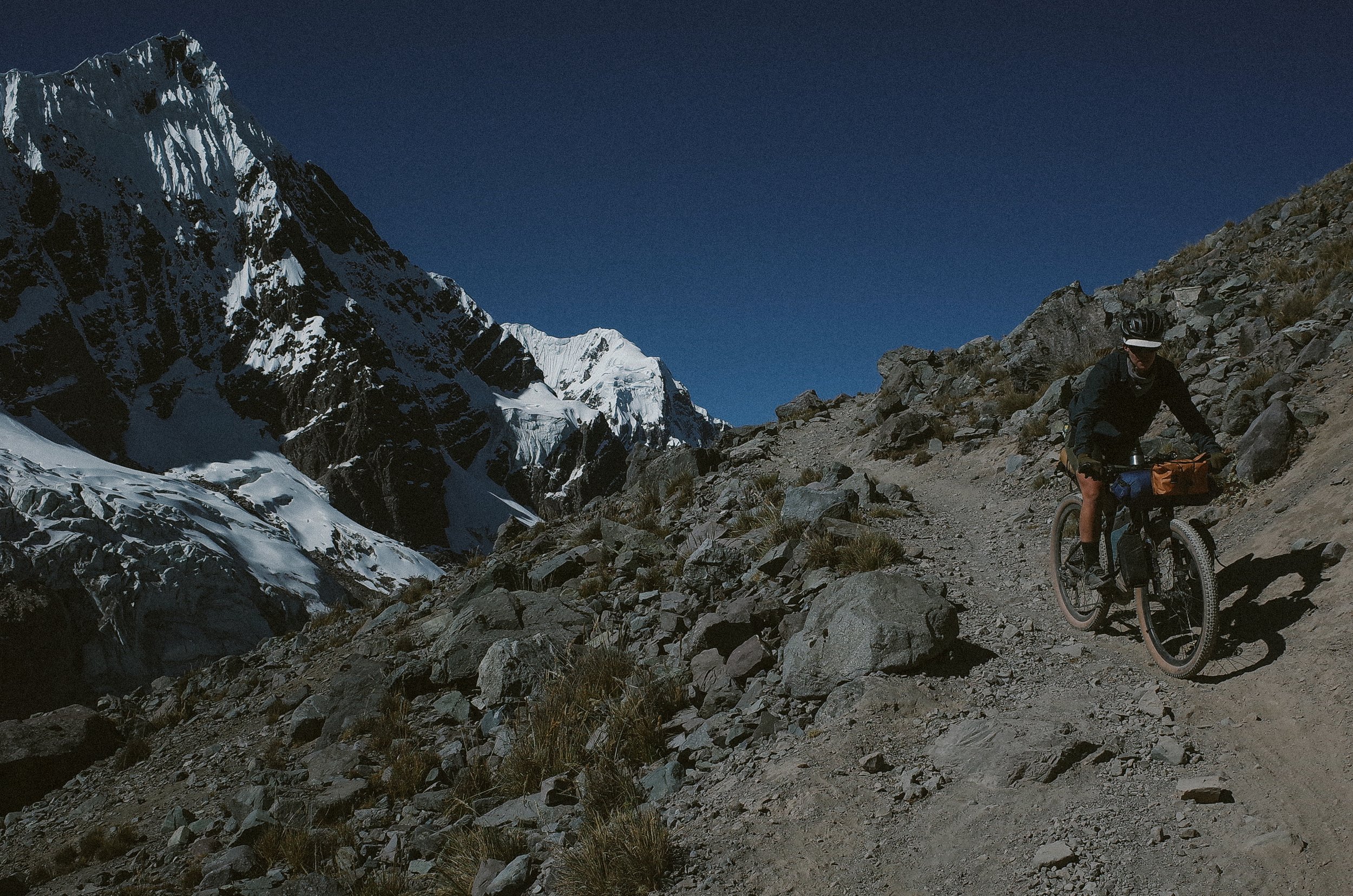
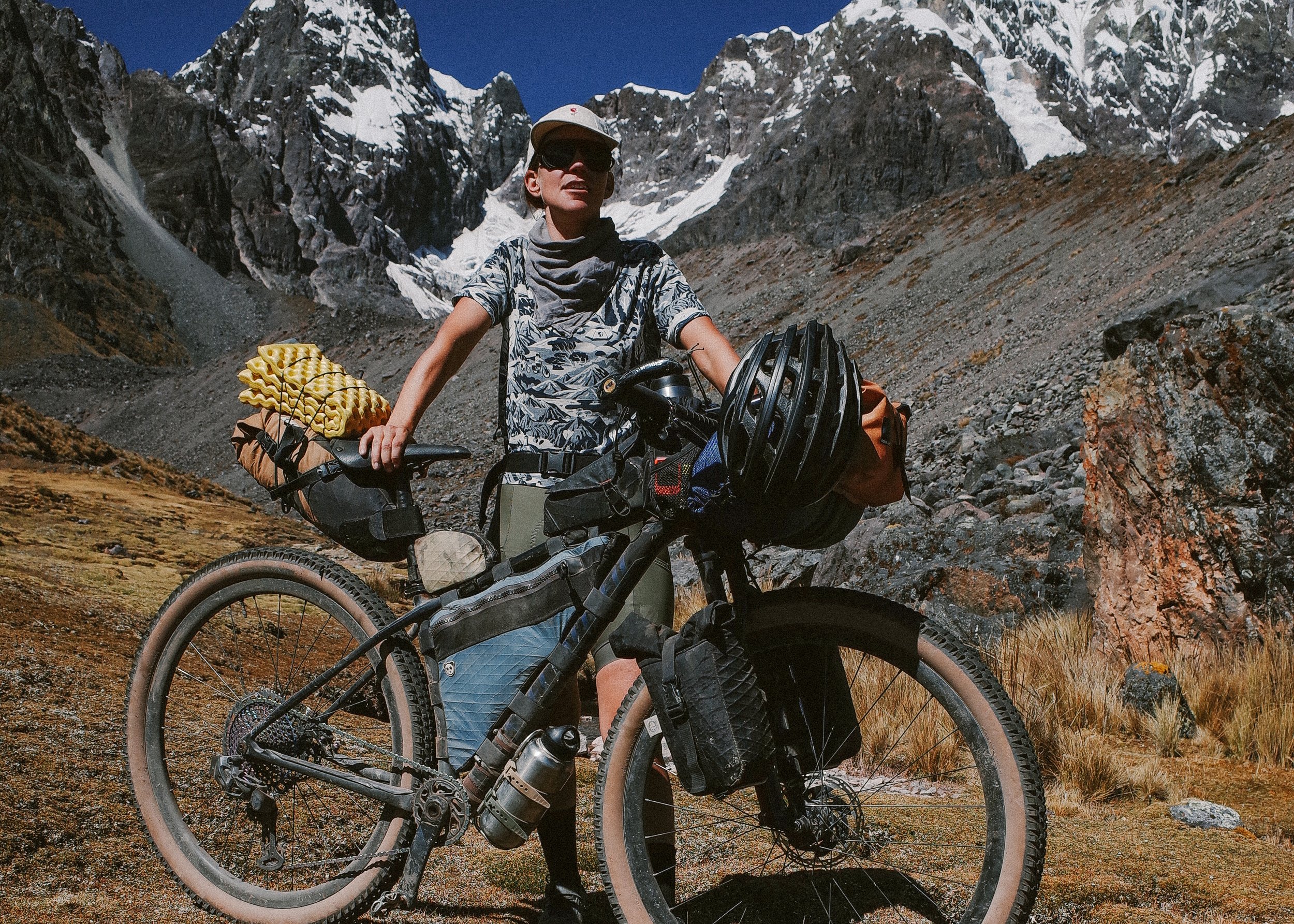
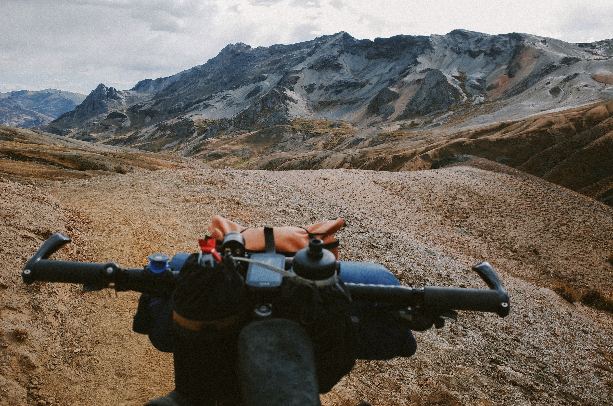
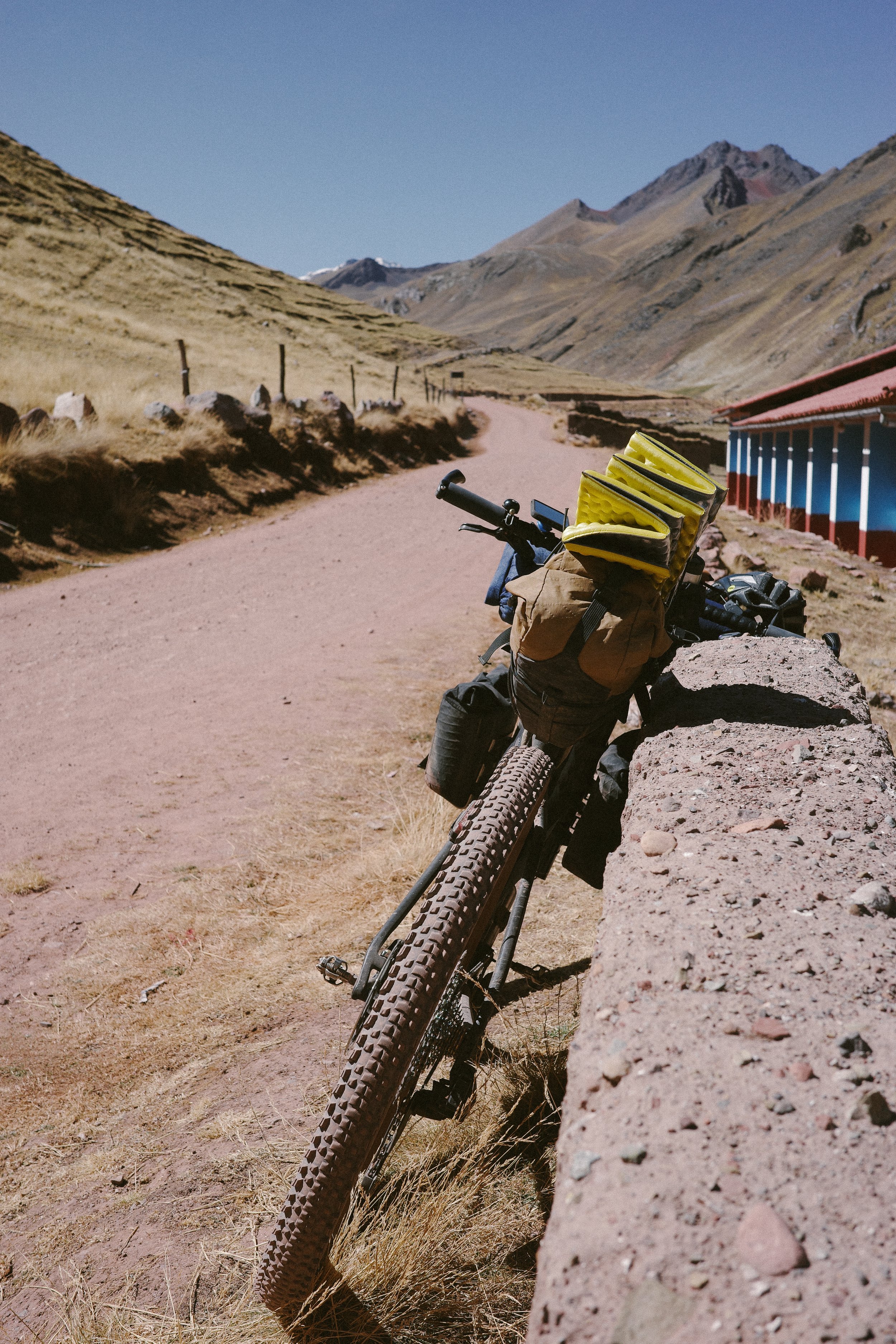
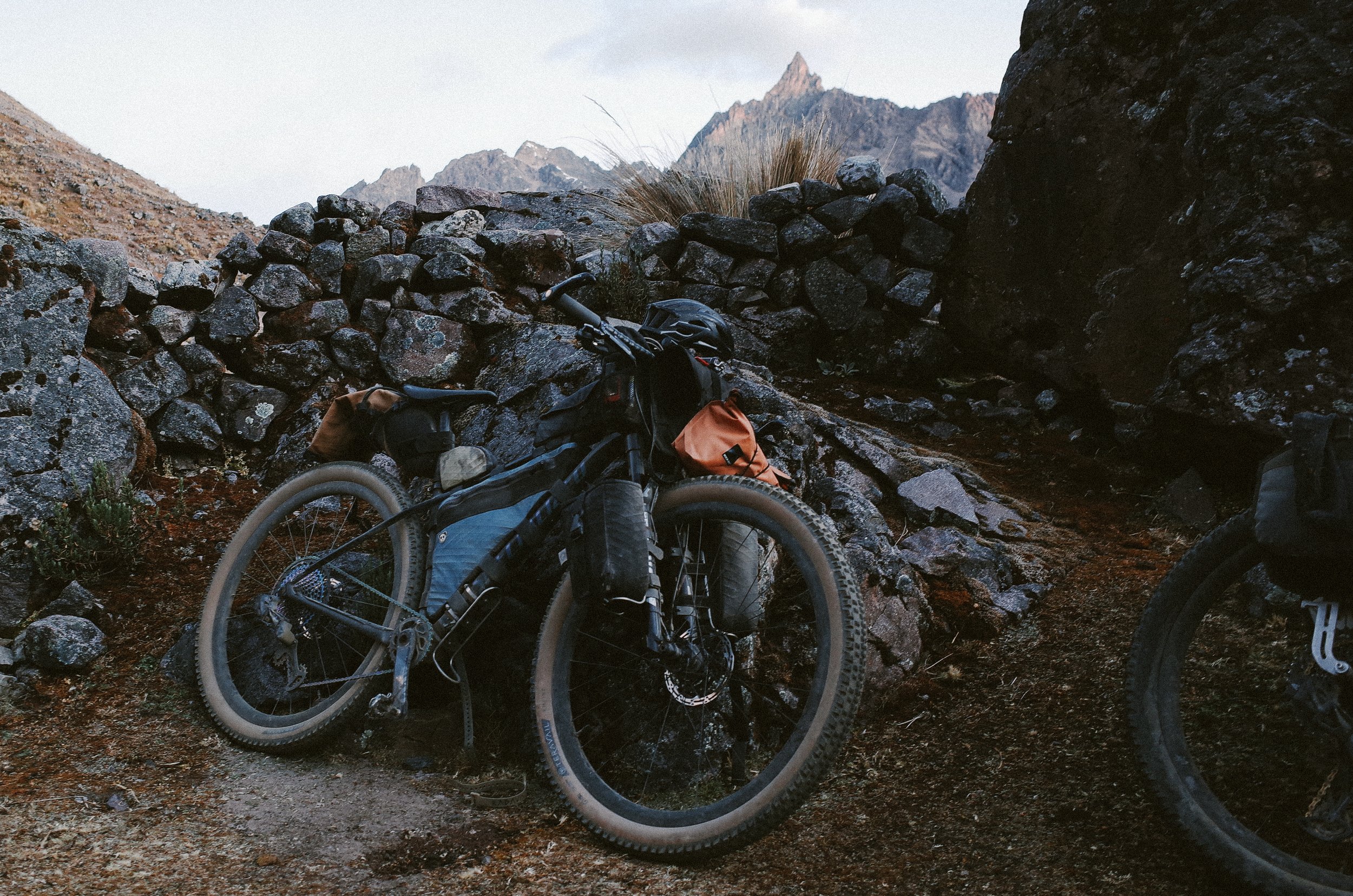
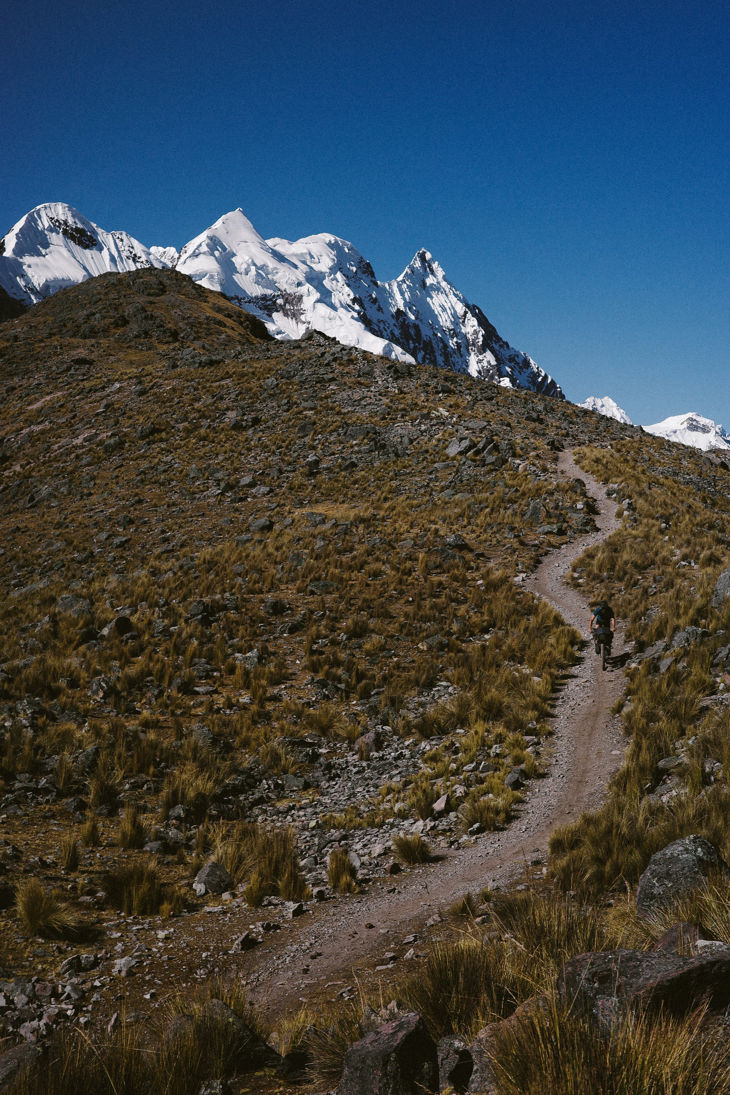
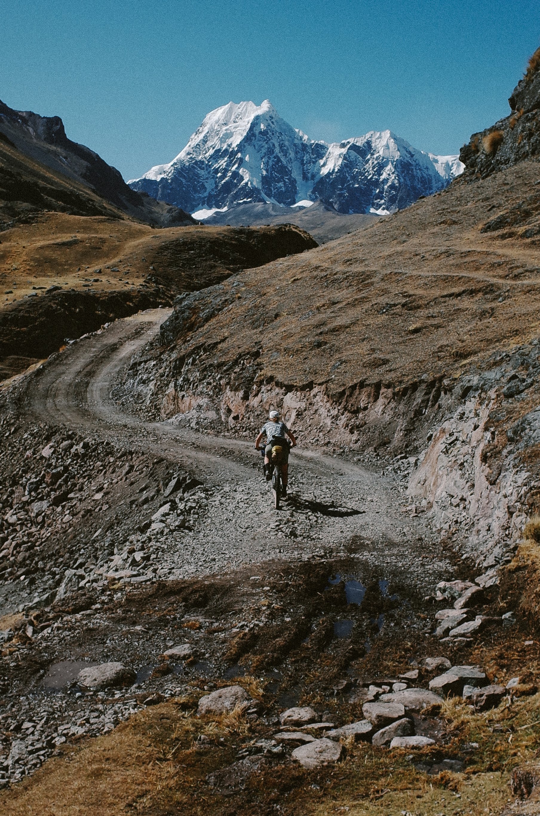
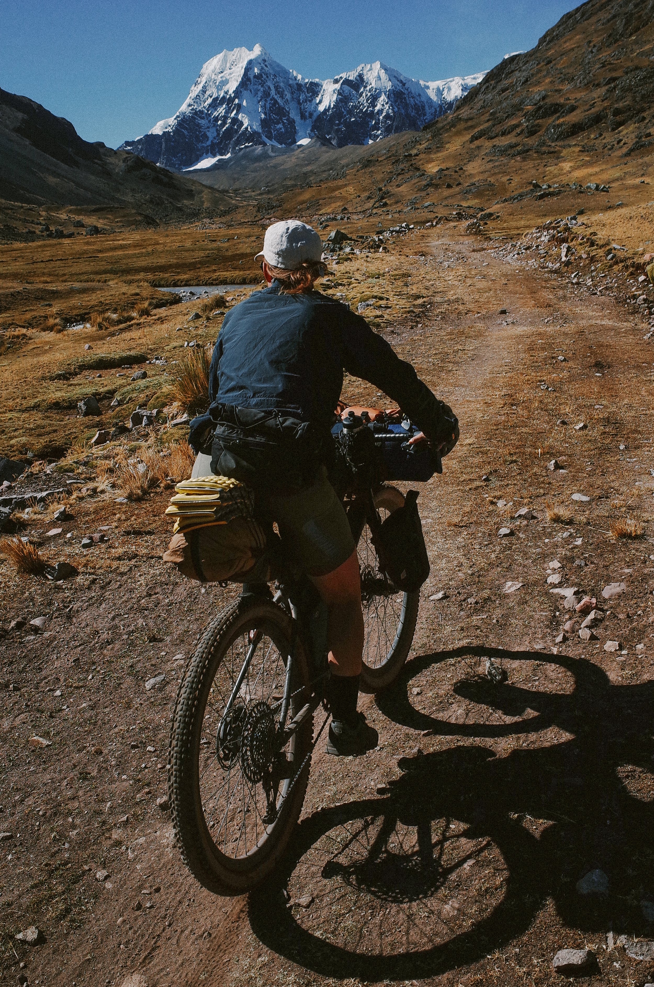
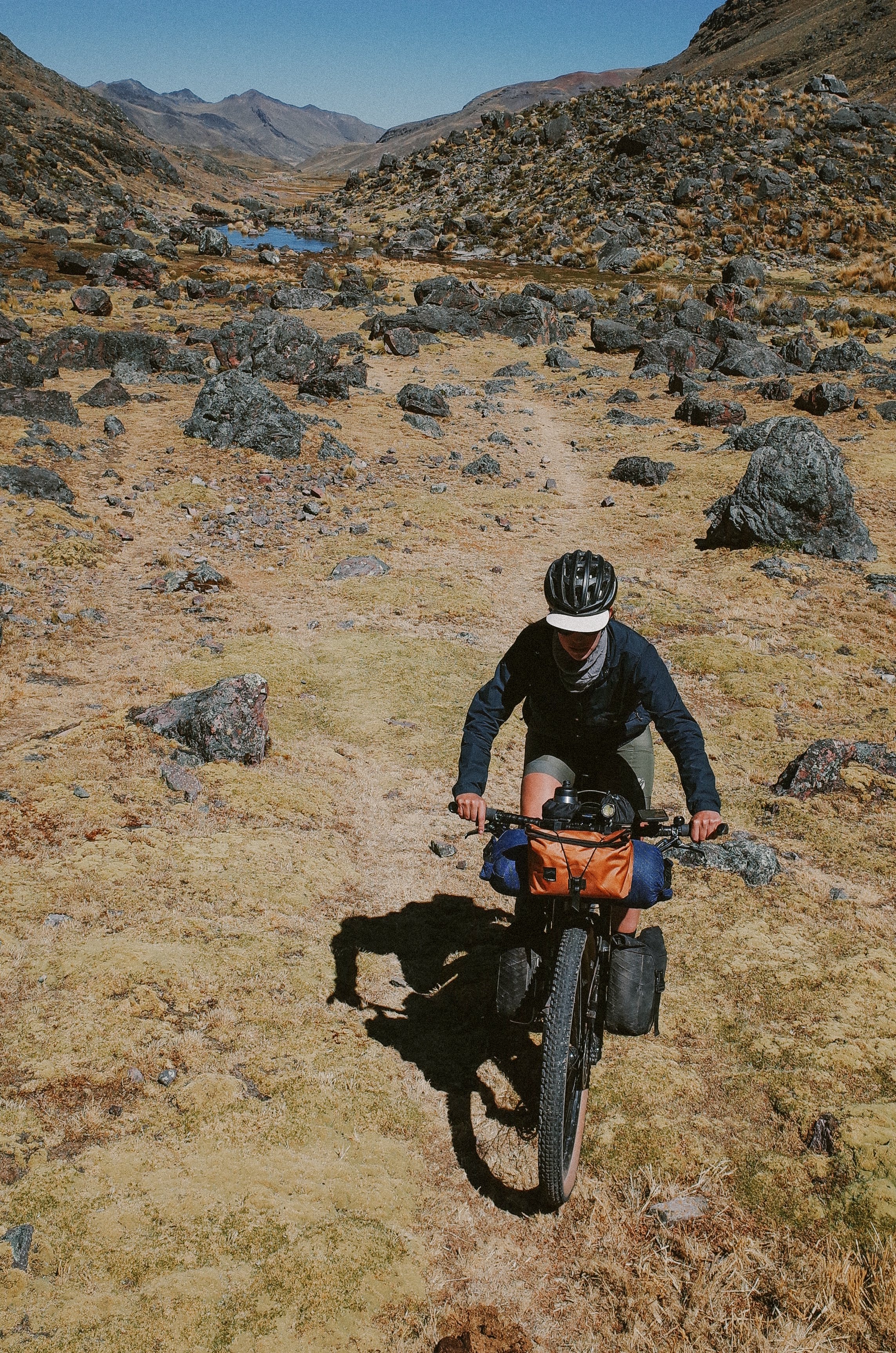
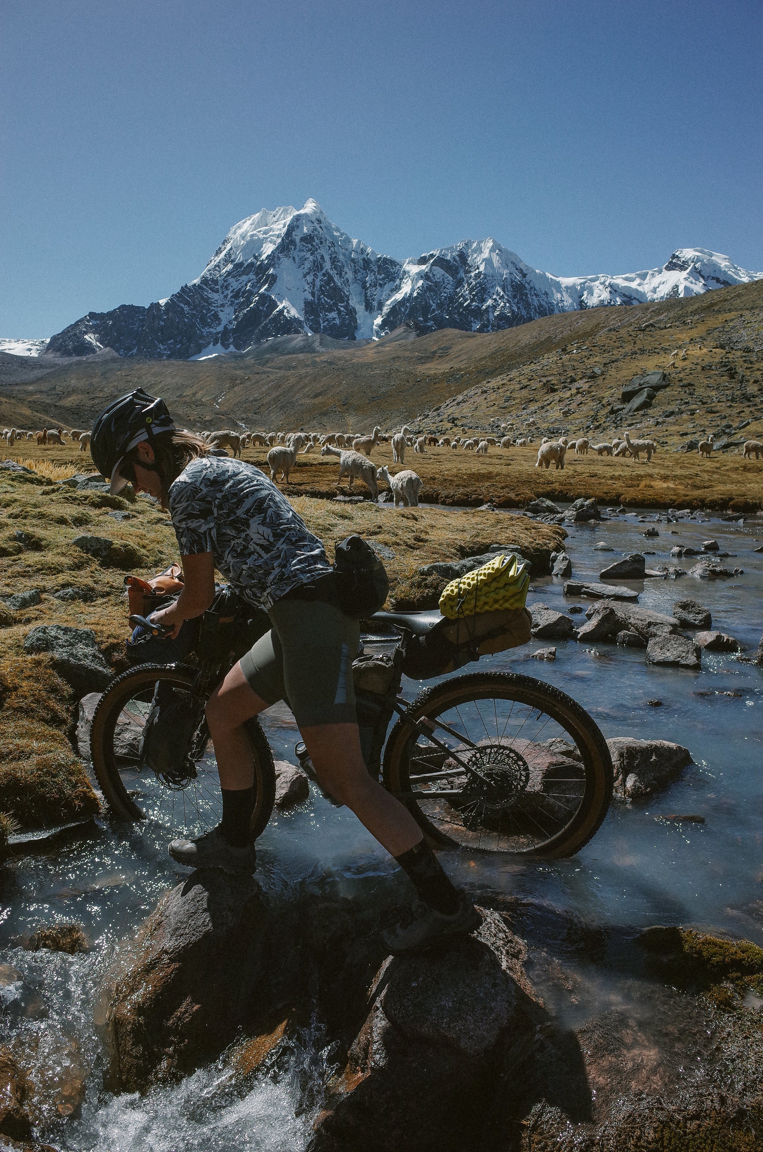
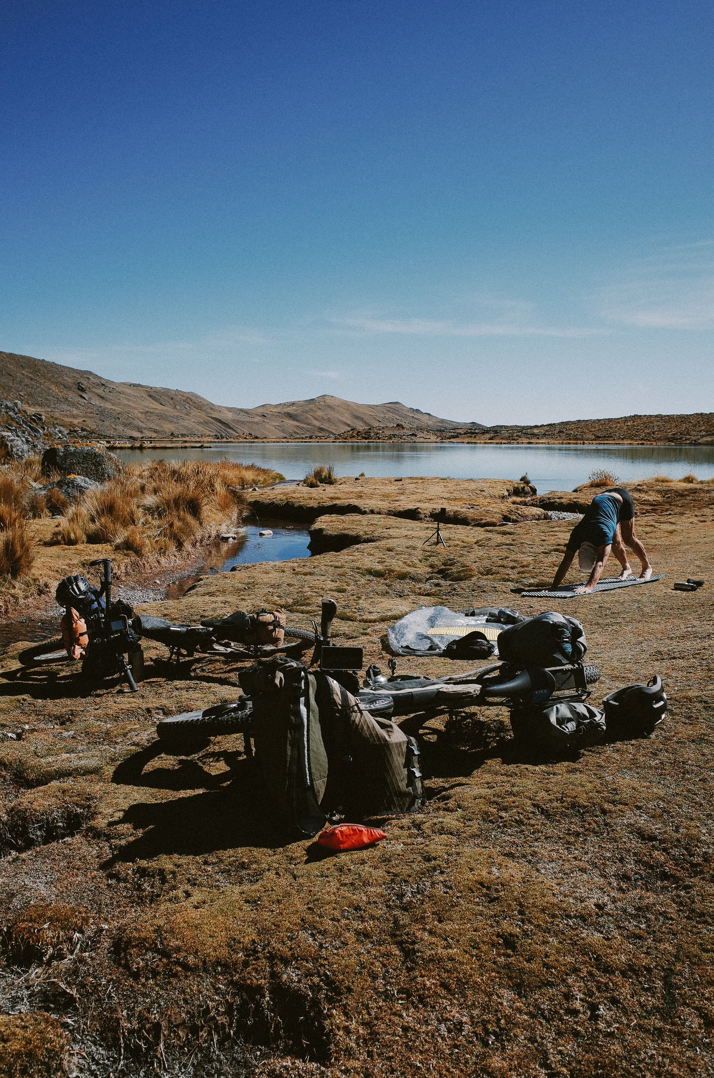
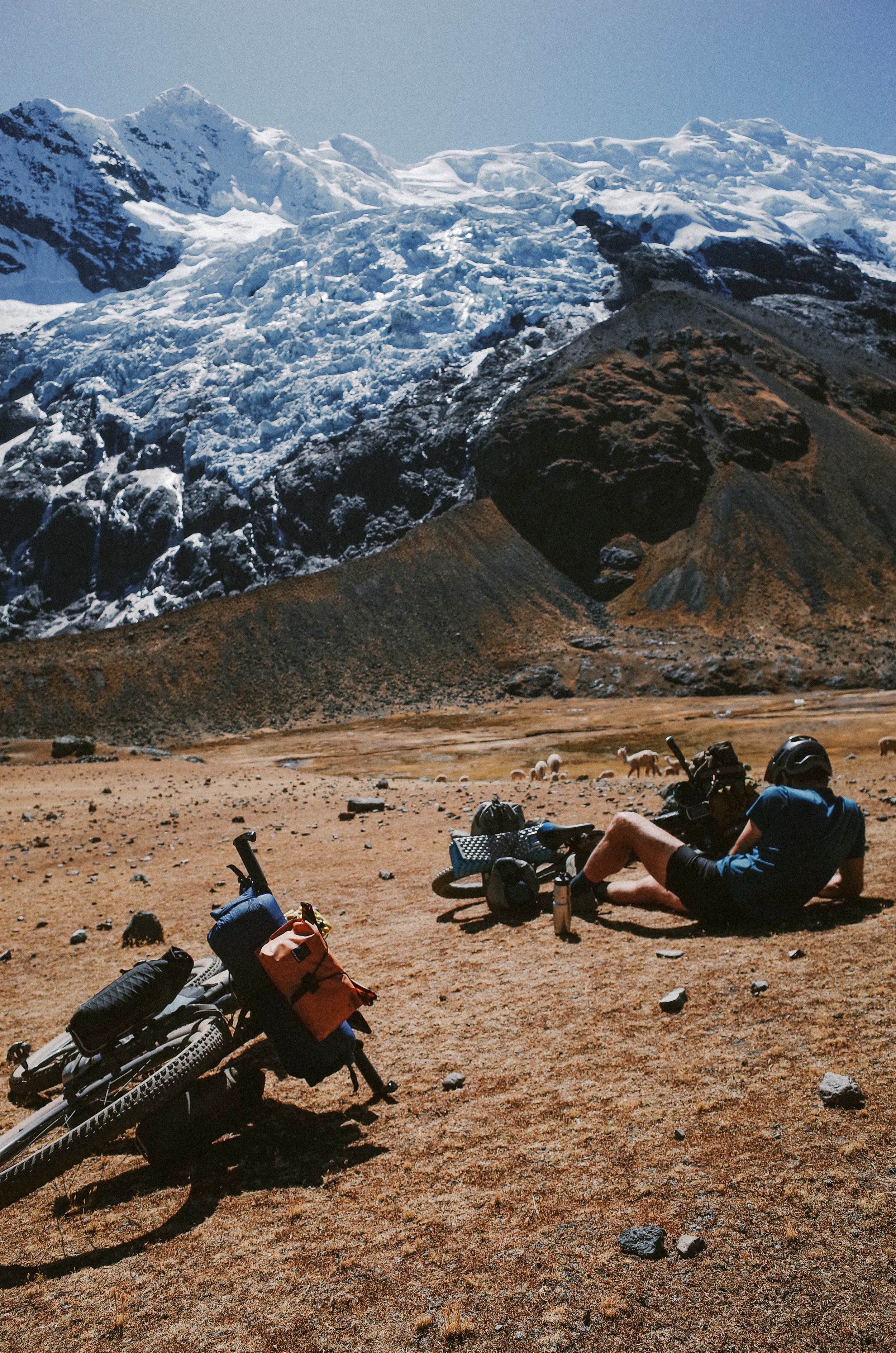
While there are many ways to ride Ausangate, the circumnavigation felt most natural and exciting to us. The circuit route alone is 37 miles with ~5,600 ft elevation gain, not including the ride to and from the Circuit or the optional Rainbow Mountain Add-On. The total distance is somewhere around 92 miles with 12,600 ft of climbing. Still, on paper, that may not sound like much, but the Ausangate Circuit part of the course exists at altitudes between 15,000 and 16,600 ft and requires a lot of interpretive navigating, riding, and hike-a-biking. Sometimes the trail is obvious and easy to follow. Other times, the route is merely an alpaca track or completely non-existent.
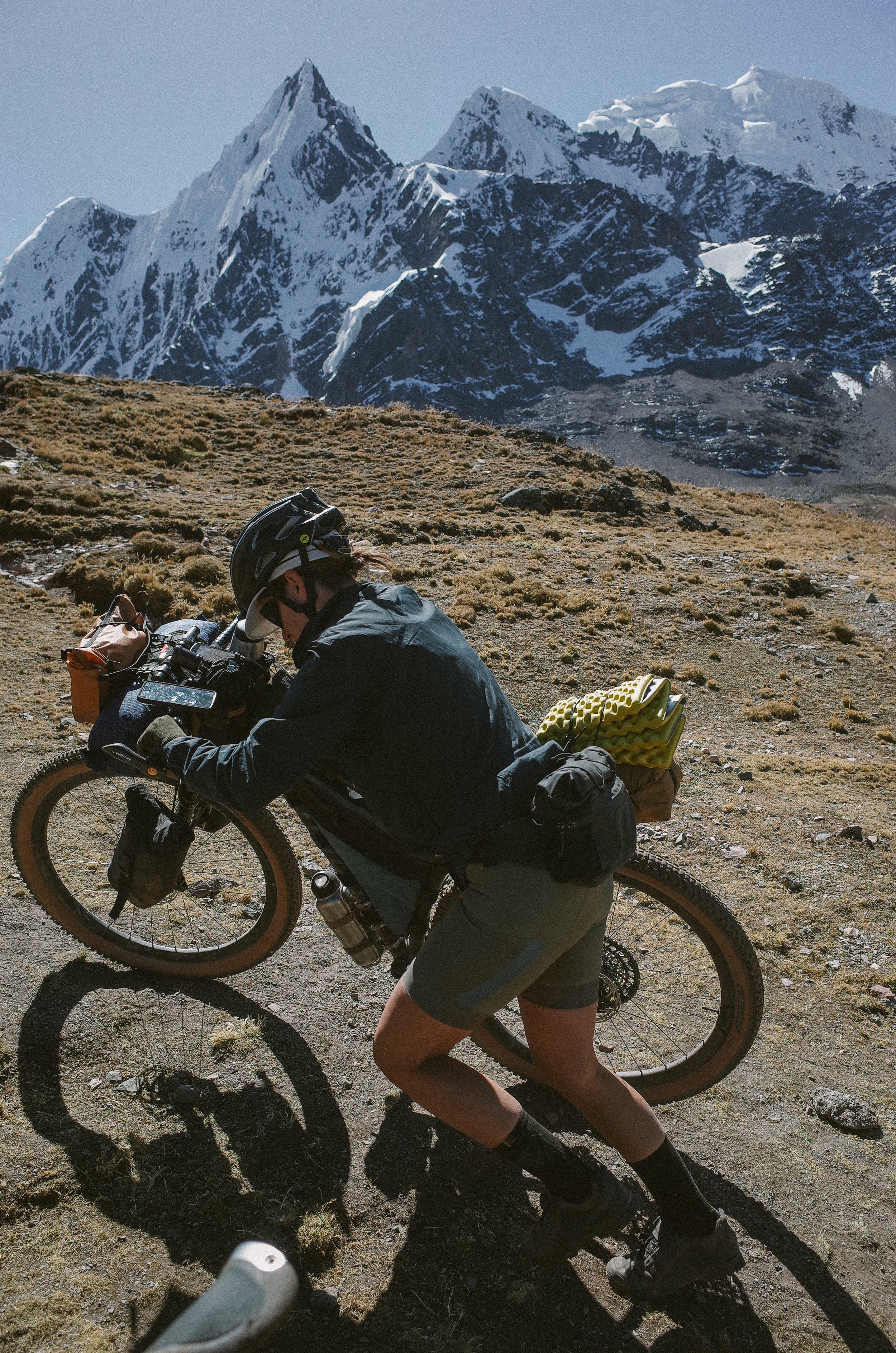
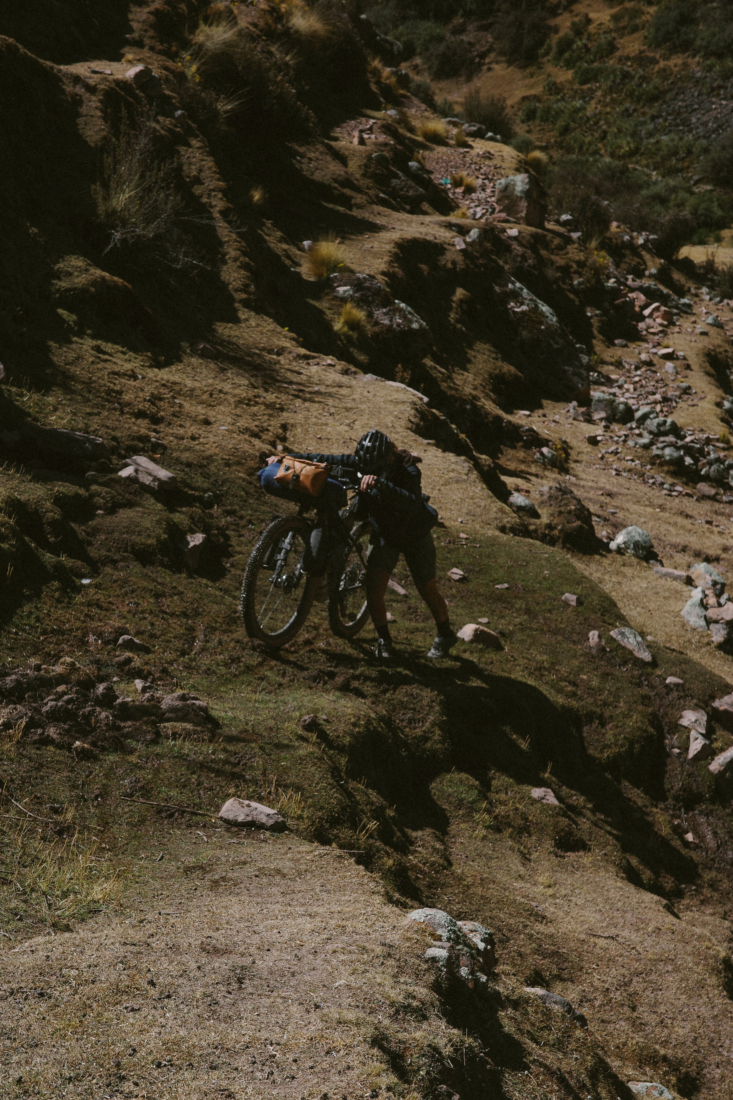
As someone who loves to follow a clear and established route, when the trail was non-existent, the Ausangate was a welcomed challenge to look up from the computer and read the landscape. The pampa is the grassland that exists at the high altitude of the Andes. When grazed by alpacas, its surface is equivalent to that of a golf course, so choosing lines over the rolling terrain is relatively easy and fun. But, of course, this method has its fair share of consequences. For instance, to avoid following an alpaca track that would lose too much elevation and require a hike-a-bike straight up the side of a hill (which happened a few too many times), we stayed a little too high for too long, requiring an 800 ft hike-a-bike straight down the side of a mountain to regain the trail. I'm still not sure which I'd prefer, but alas, that is what it's like to ride the Ausangate Circuit.
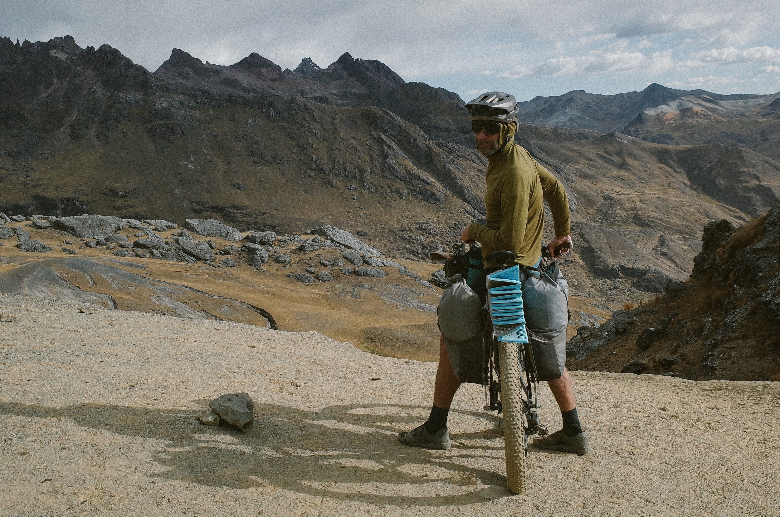
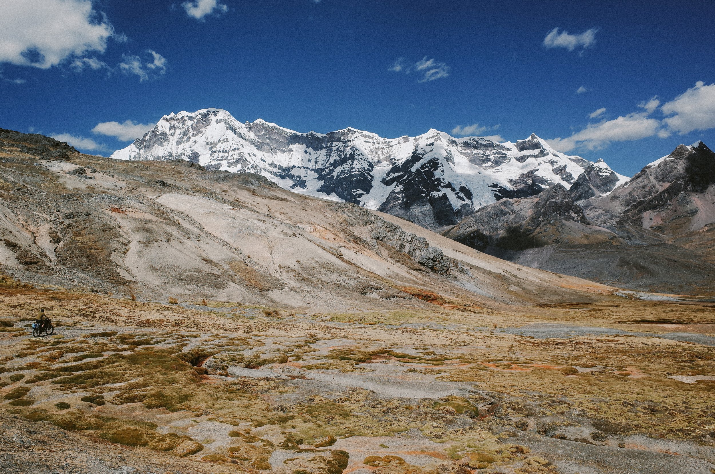
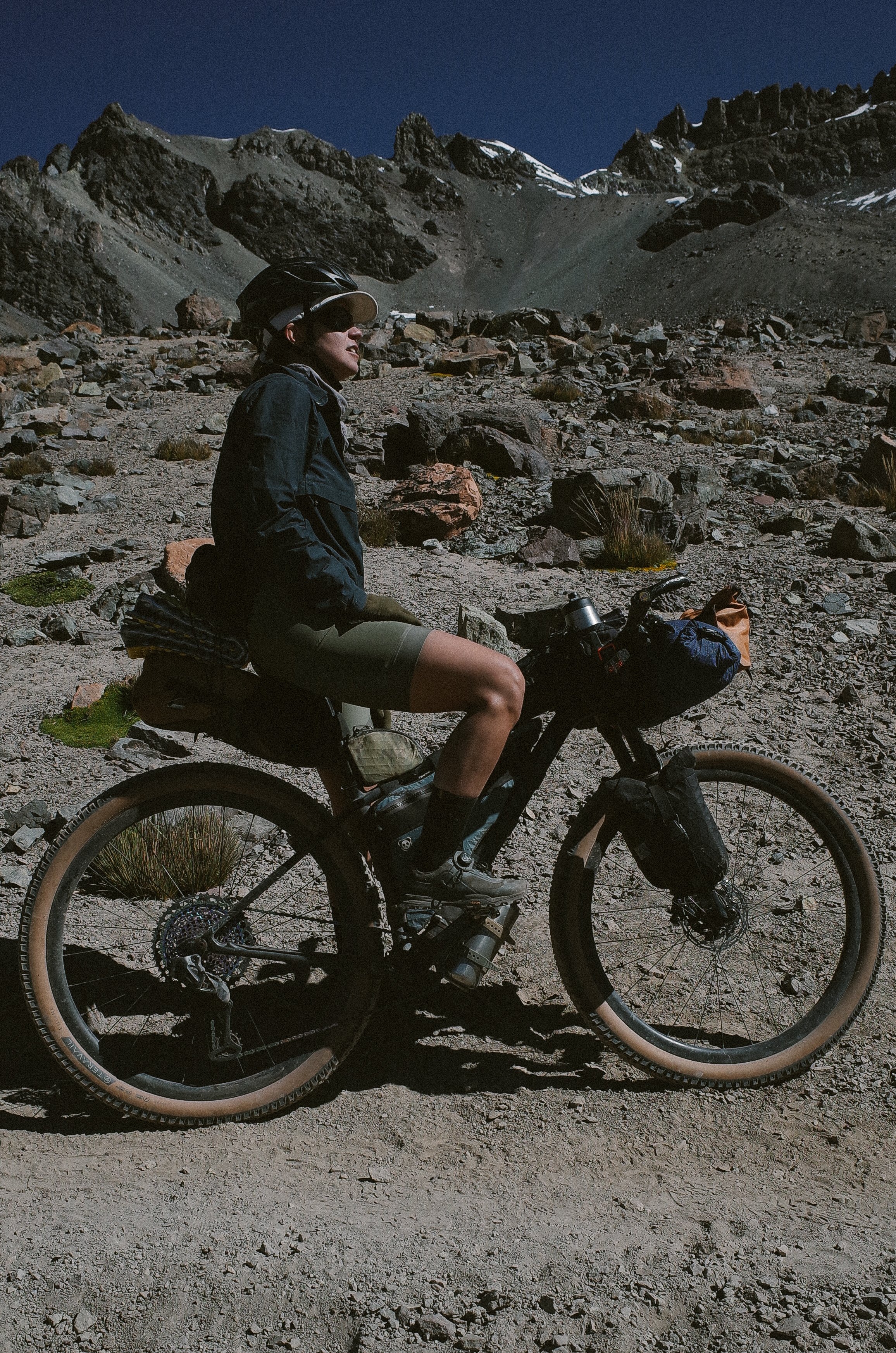
As for the climbs, they were rideable to a certain point, after which we would settle in for the long and demanding push, lift, and pull of our 50 lb. touring bikes up the last 600 to 1,000 ft to one of the four mountain passes on the route. Of course, the reward of so much effort was riding the glorious singletrack descents on the other side. They were thrilling and worth every minute of pushing.
Perhaps the most intimidating element of riding the Ausangate Circuit is figuring out how to acclimate to riding at altitudes between 15,000 to 16,600 ft. If you do not acclimate properly, gaining too much altitude too quickly can result in mild symptoms of altitude sickness (headache, nausea, dizziness) and life-threatening symptoms (a build-up of fluid in your lungs or brain). So, properly acclimating is key to taking on the Ausangate Circuit.
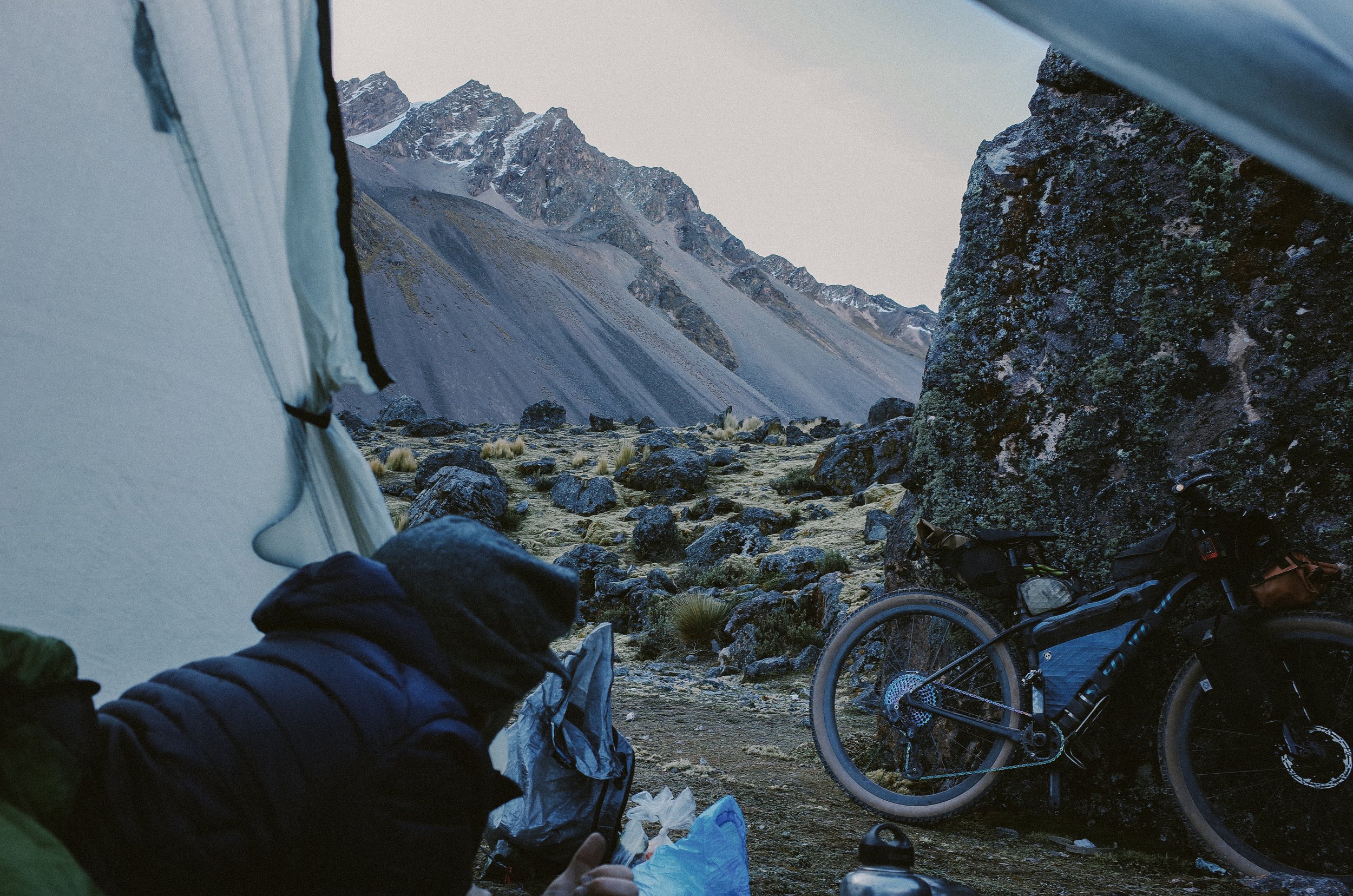
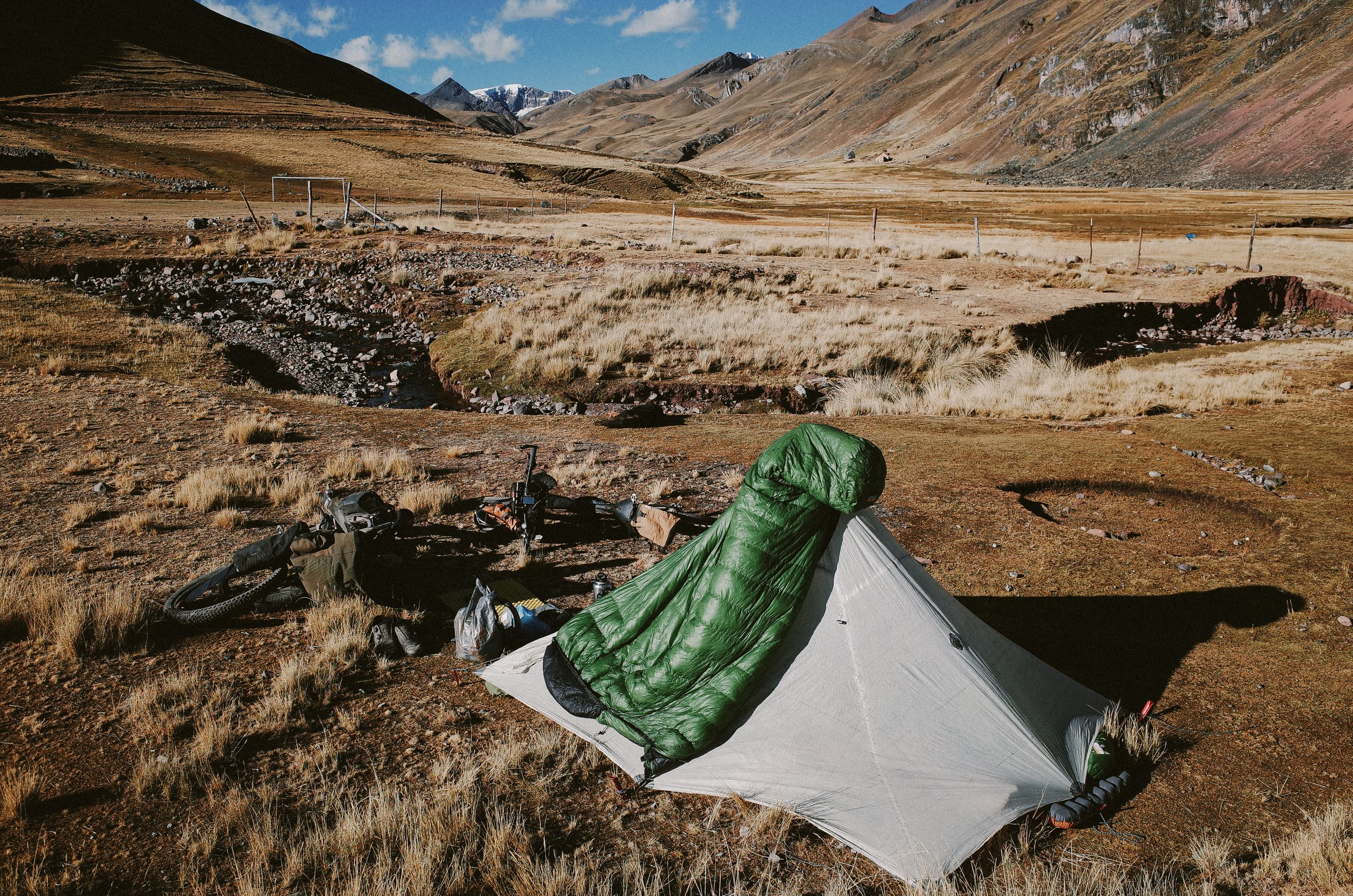
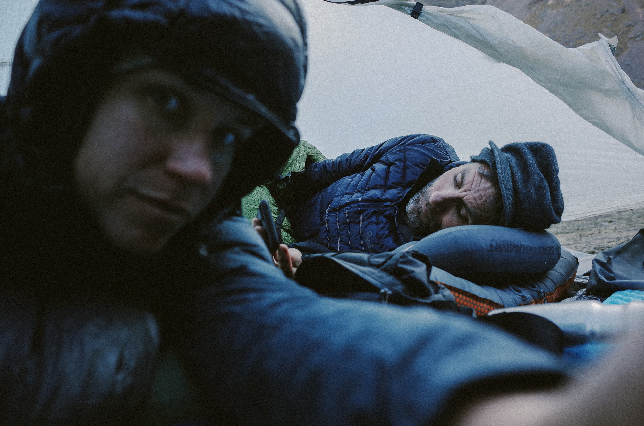
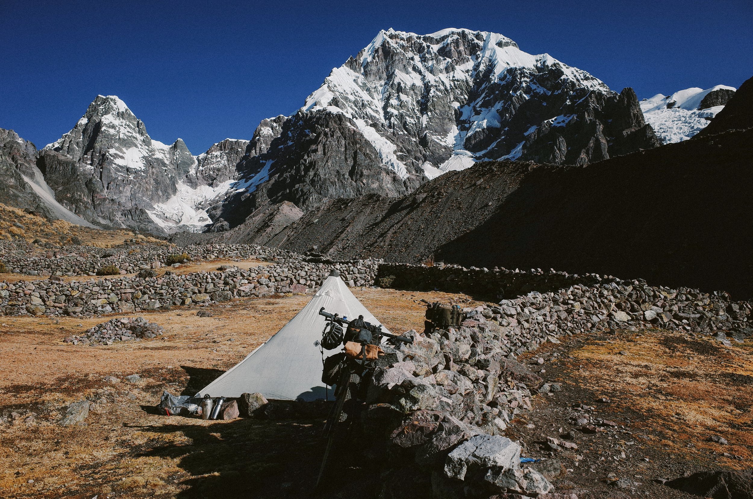
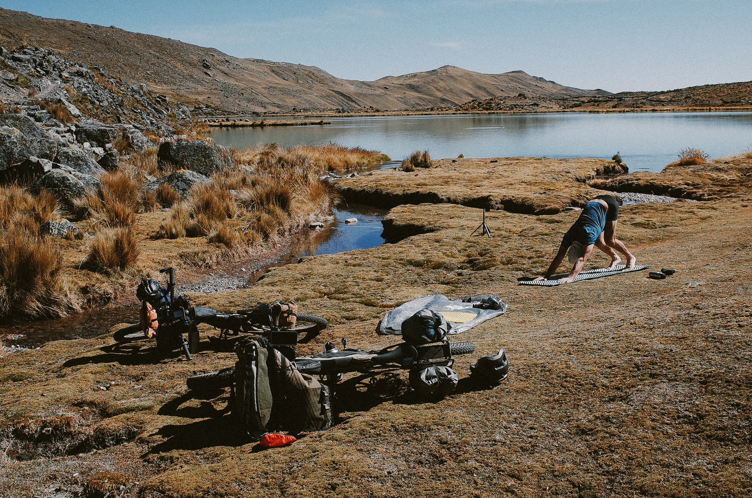
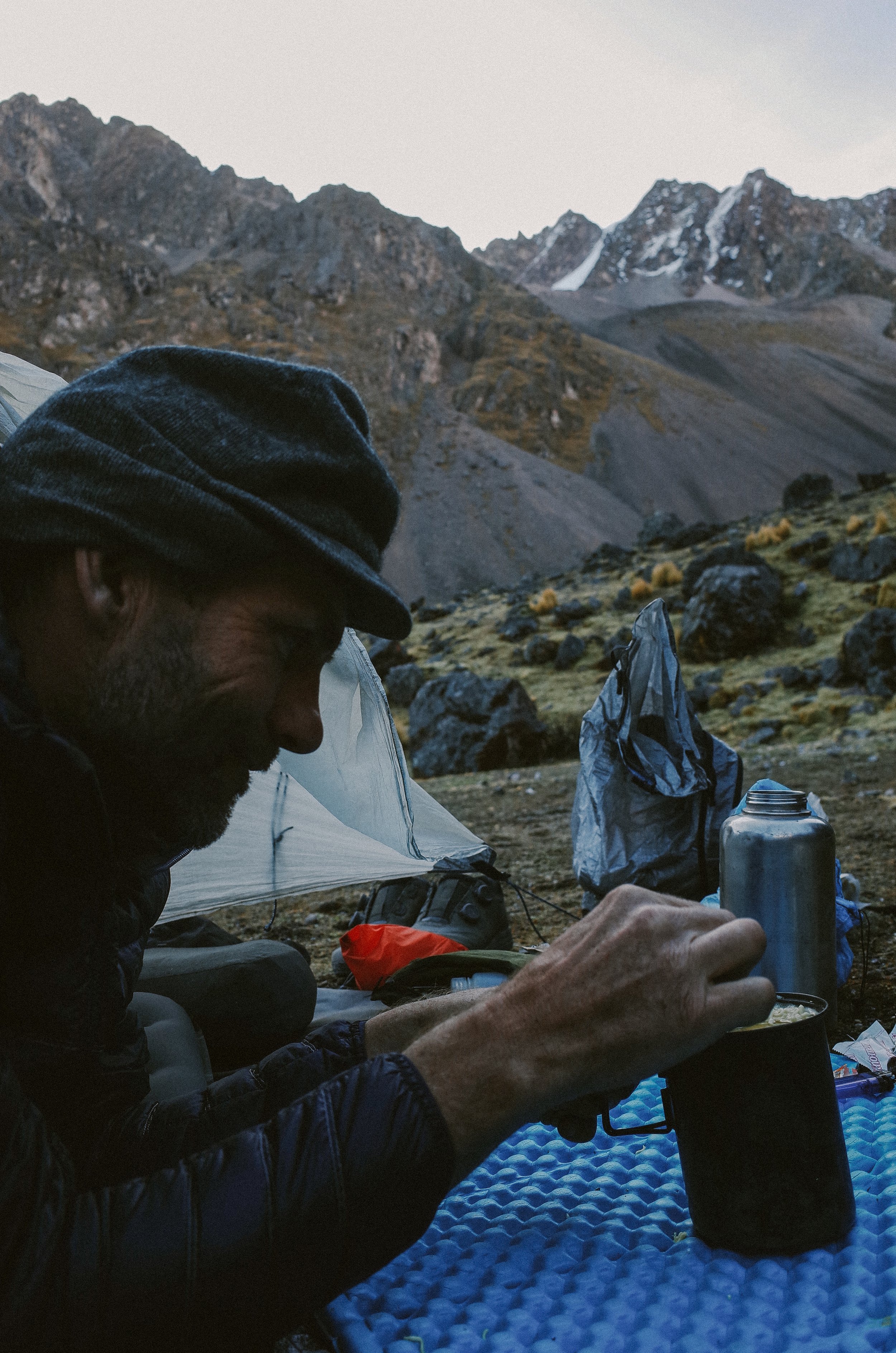
Having toured the altiplano of Peru twice before this trip and getting mild altitude sickness once, I had a fair idea of what would work for us. After our week in the low altitudes of the Amazon, we acclimated to 11,200 ft for a couple of days in Cusco before taking a cab to Pitumarca, a small town situated at 11,700 ft and approximately 25 miles south of the start of the Ausangate Circuit. From there, we climbed to and camped at 13,000 ft. The following day we climbed to approximately 14,200 ft. and stayed at 14,200 ft for two nights. After two days of acclimatizing to 14,200 ft, we climbed up to 15,000 ft and set up an early camp at the start of the Circuit. From then on, we climbed over the passes during the day and camped as low as we could at night (beneath 15,300 ft).
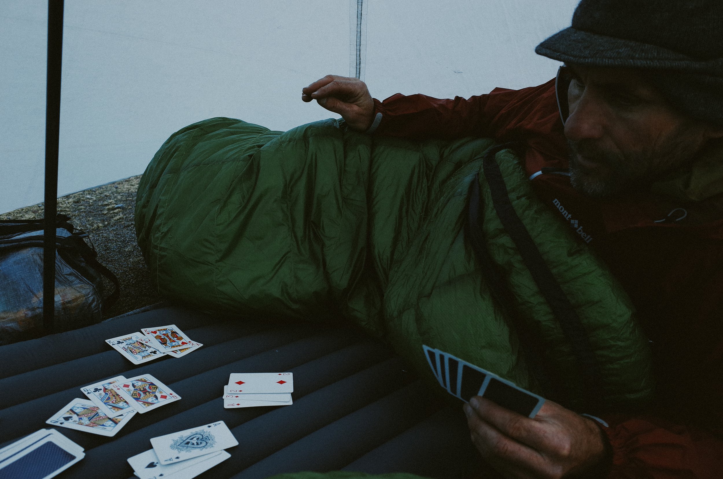
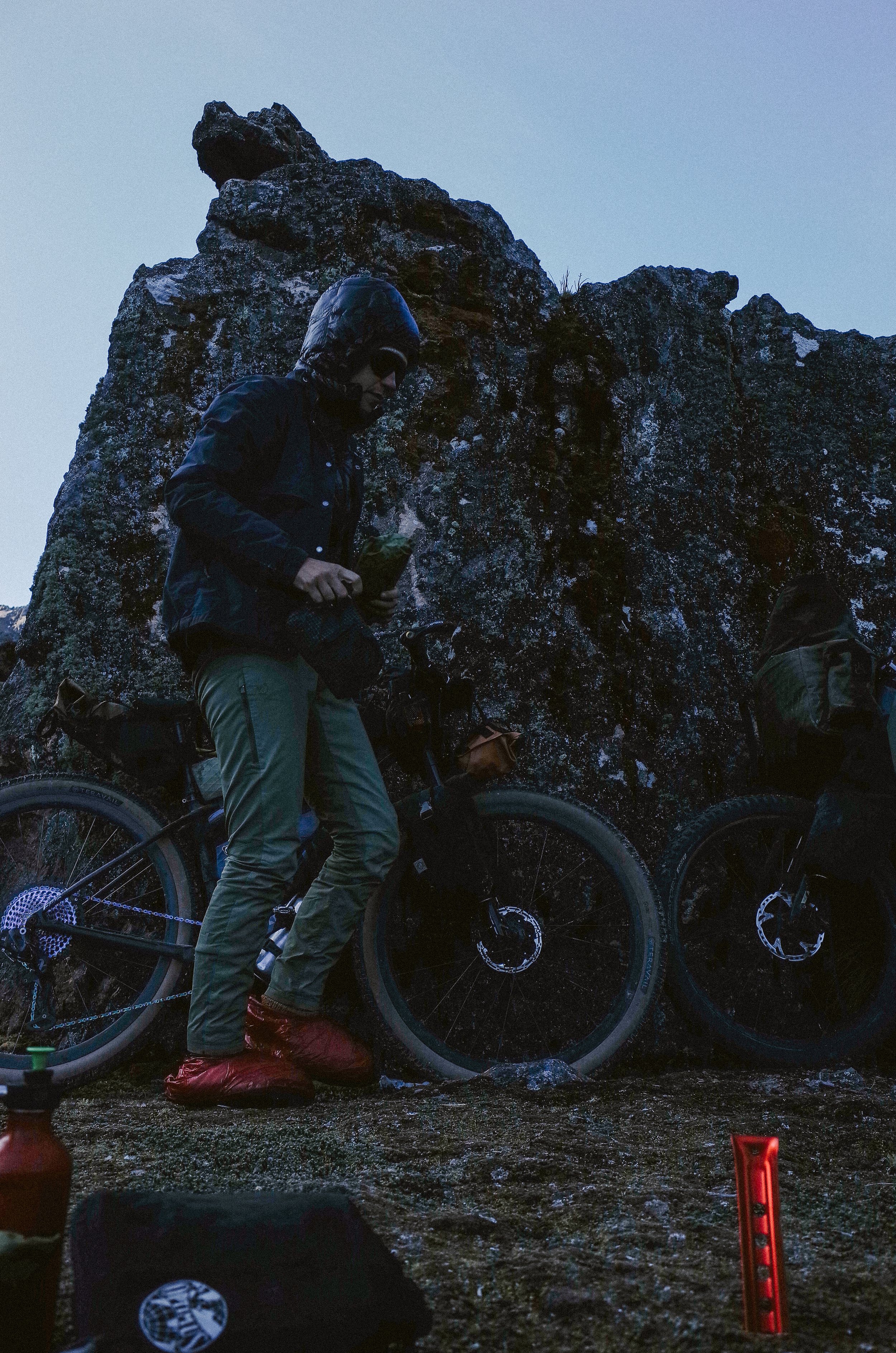
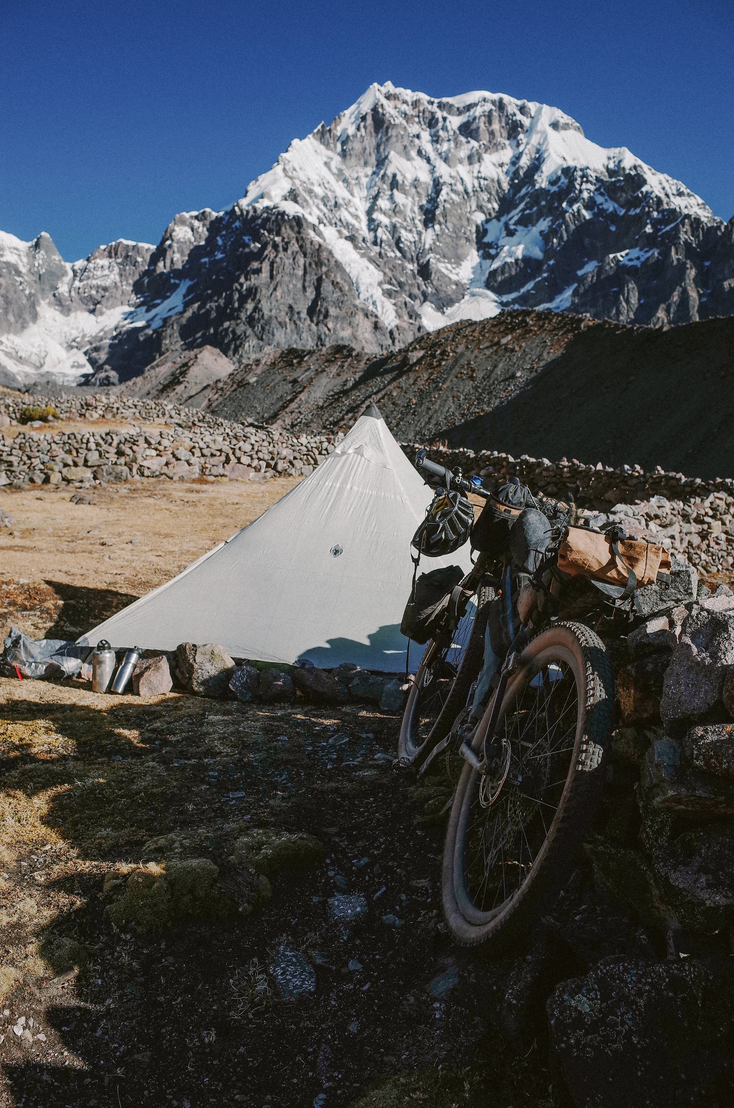
The temperatures at these altitudes are essential to consider. We completed our tour in late June, which is within the dry season, but also Peru's winter, which meant we enjoyed dry and sunny weather during the day and were contending with freezing nighttime temperatures. We brought our warmest sleeping bags rated down to 10 degrees Fahrenheit, wore all our clothes, and were still cold at night. On some nights, the water in our bottles froze by 9 p.m. To help us sleep more comfortably, we each purchased six rolls of alpaca yarn in the small village of Chillca, located just before the start of the Ausangate Circuit. We unraveled the yarn and bundled the sweaters' worth at the bottom of our sleeping bag each night, and it did the trick of keeping our toes warm.
While the Ausangate Circuit may not be the easiest route in Peru, it may be the most convenient tour to incorporate into a trip that also centers on some of Peru's more popular tourist experiences of Machu Picchu, The Sacred Valley, and the city of Cusco. But, consider yourself warned. This route is not for the faint of heart and requires a certain level of respect and preparation. To assist the hearty souls who want to get after it, I include a brief guide to show how we approached our ride below.
Route Guide
Routes
Ausangate Circuit: https://ridewithgps.com/routes/40598659
Route to and from Ausangate Circuit from Pitumarca: https://ridewithgps.com/routes/40598642
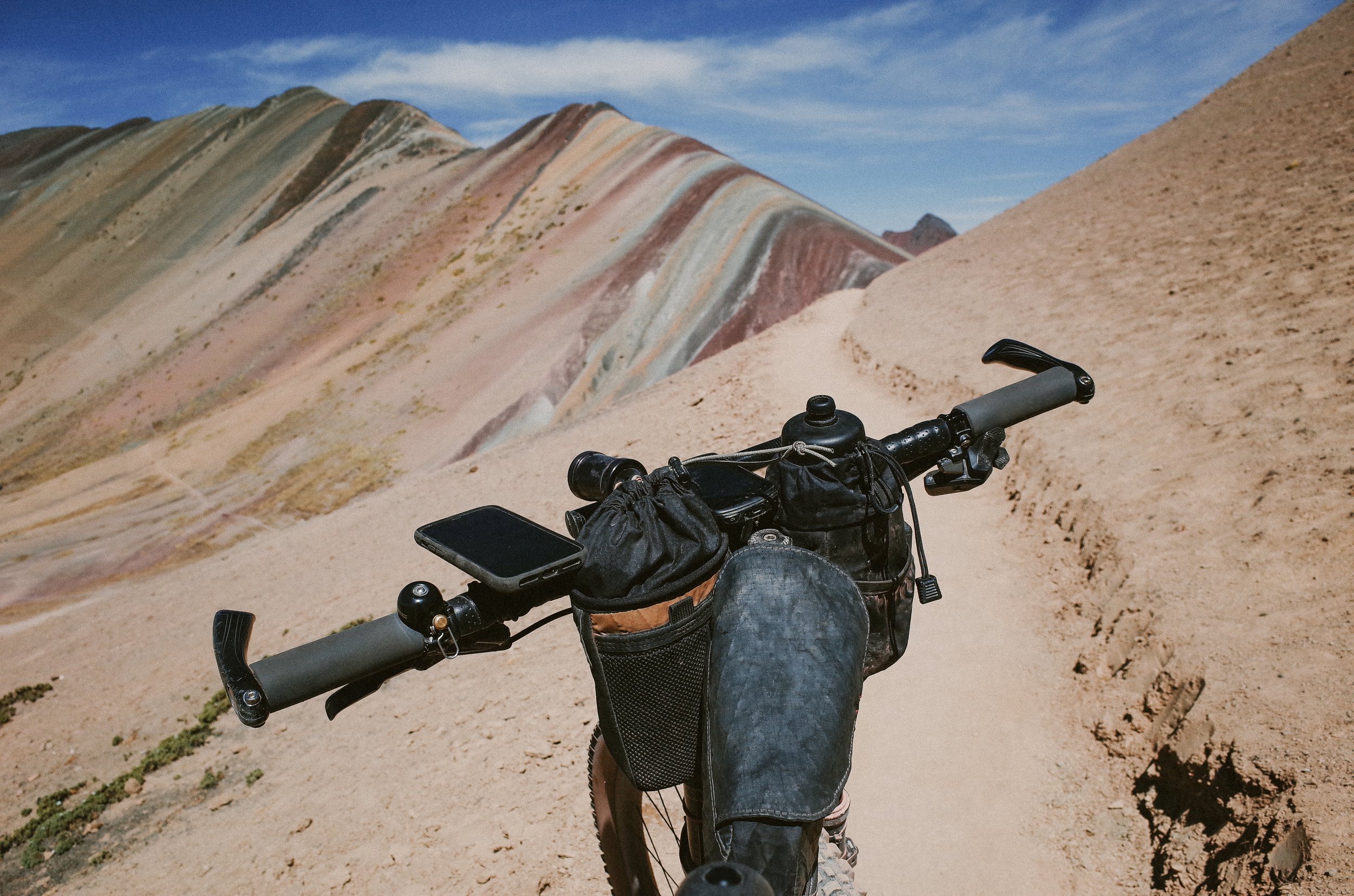
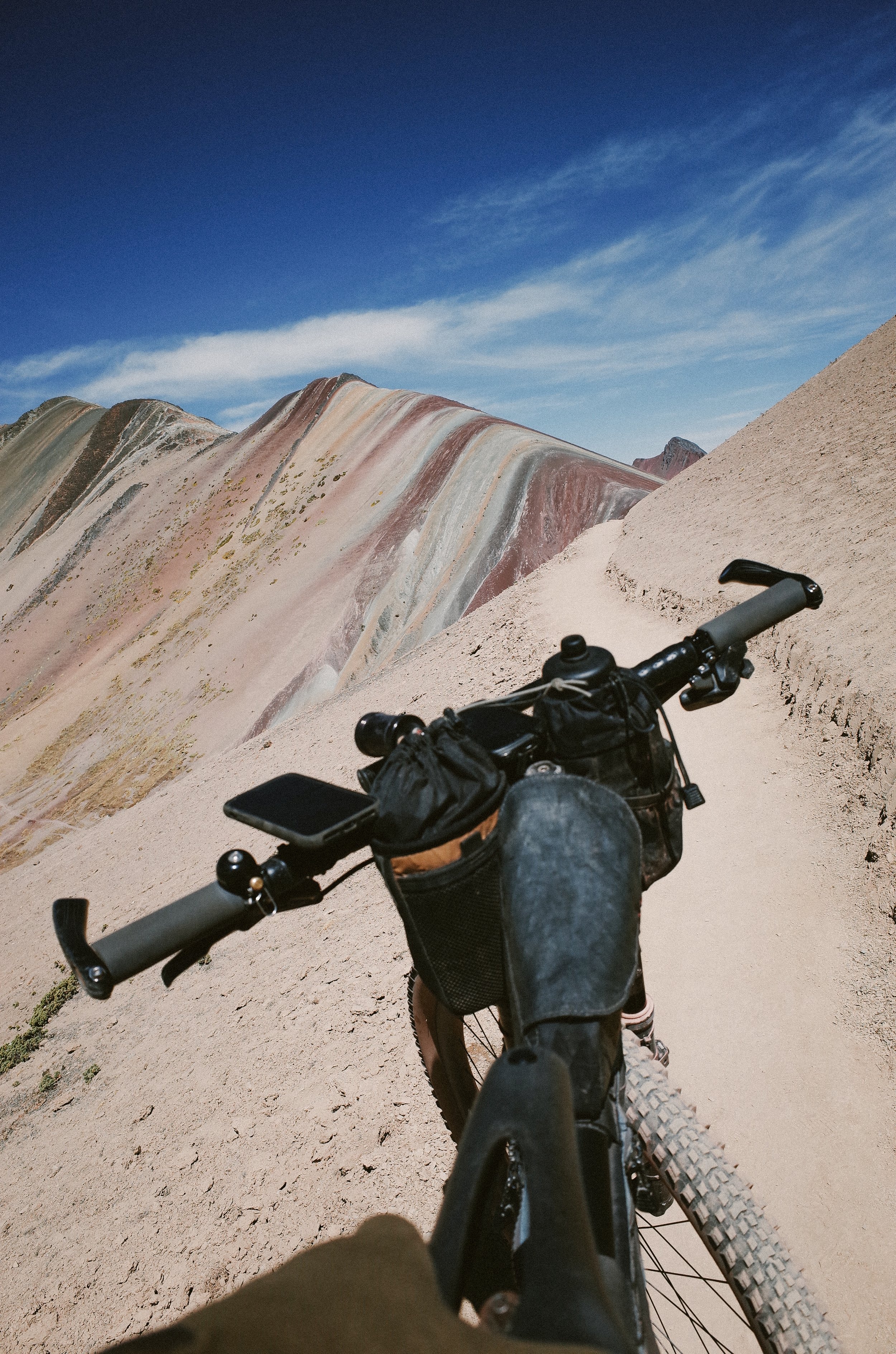
Rainbow Mountain (Add-on): https://ridewithgps.com/routes/40598879
Highlights
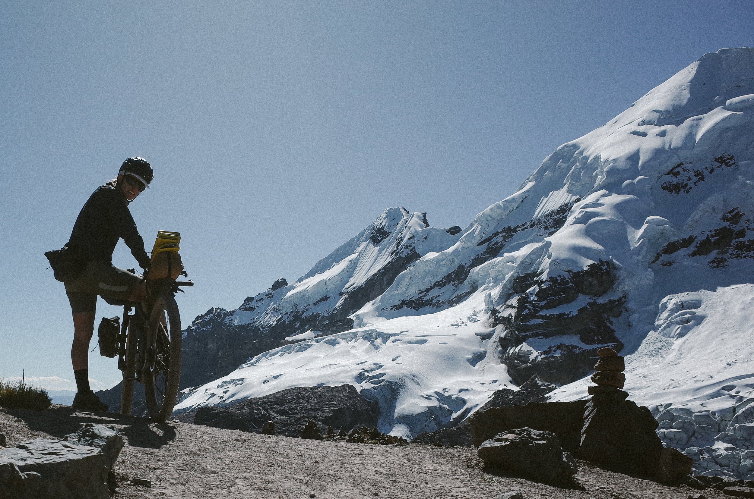
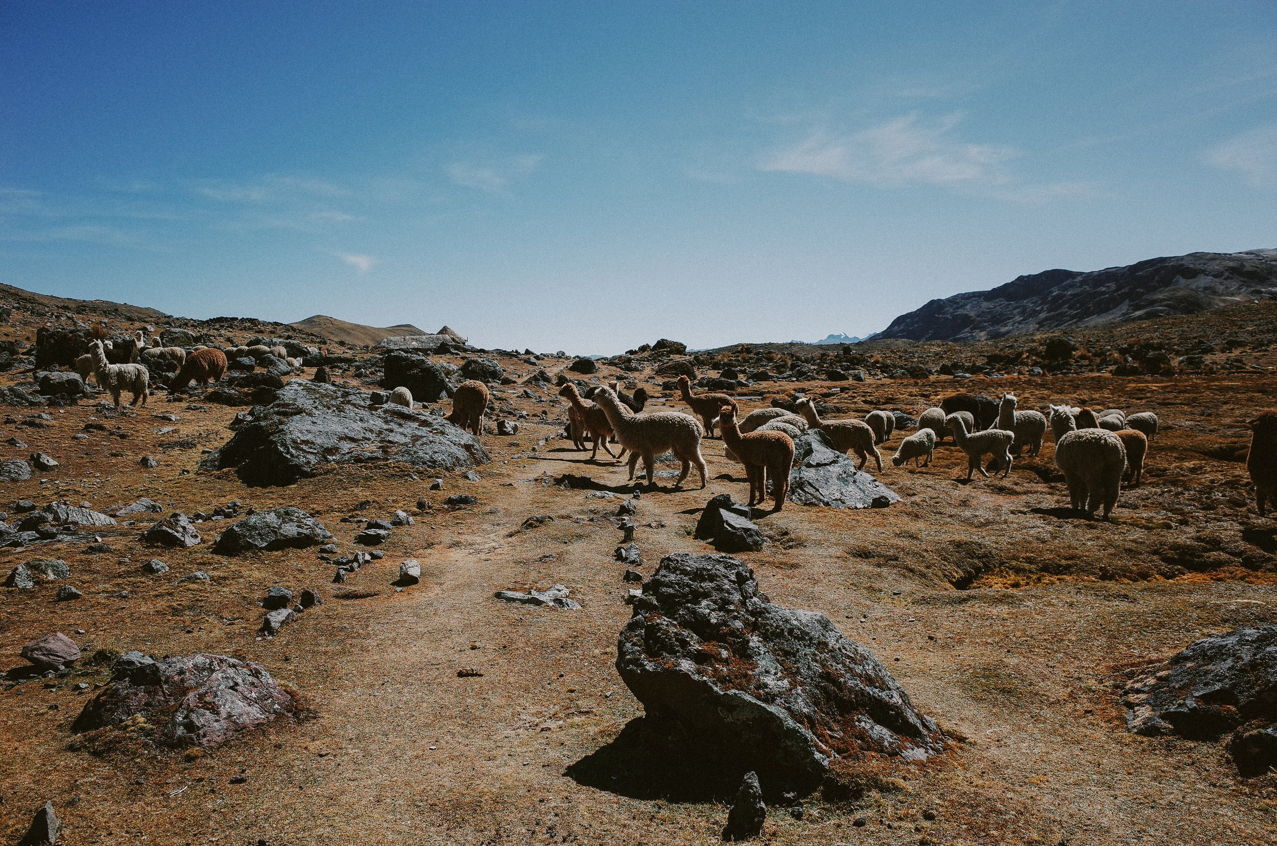
An impressive 360-degree perspective of Nevado Ausangate and its remarkable glaciers
Camping next to aqua blue lakes
Amazing star-gazing and Milky Way viewing
Abundant glacial streams and rivers
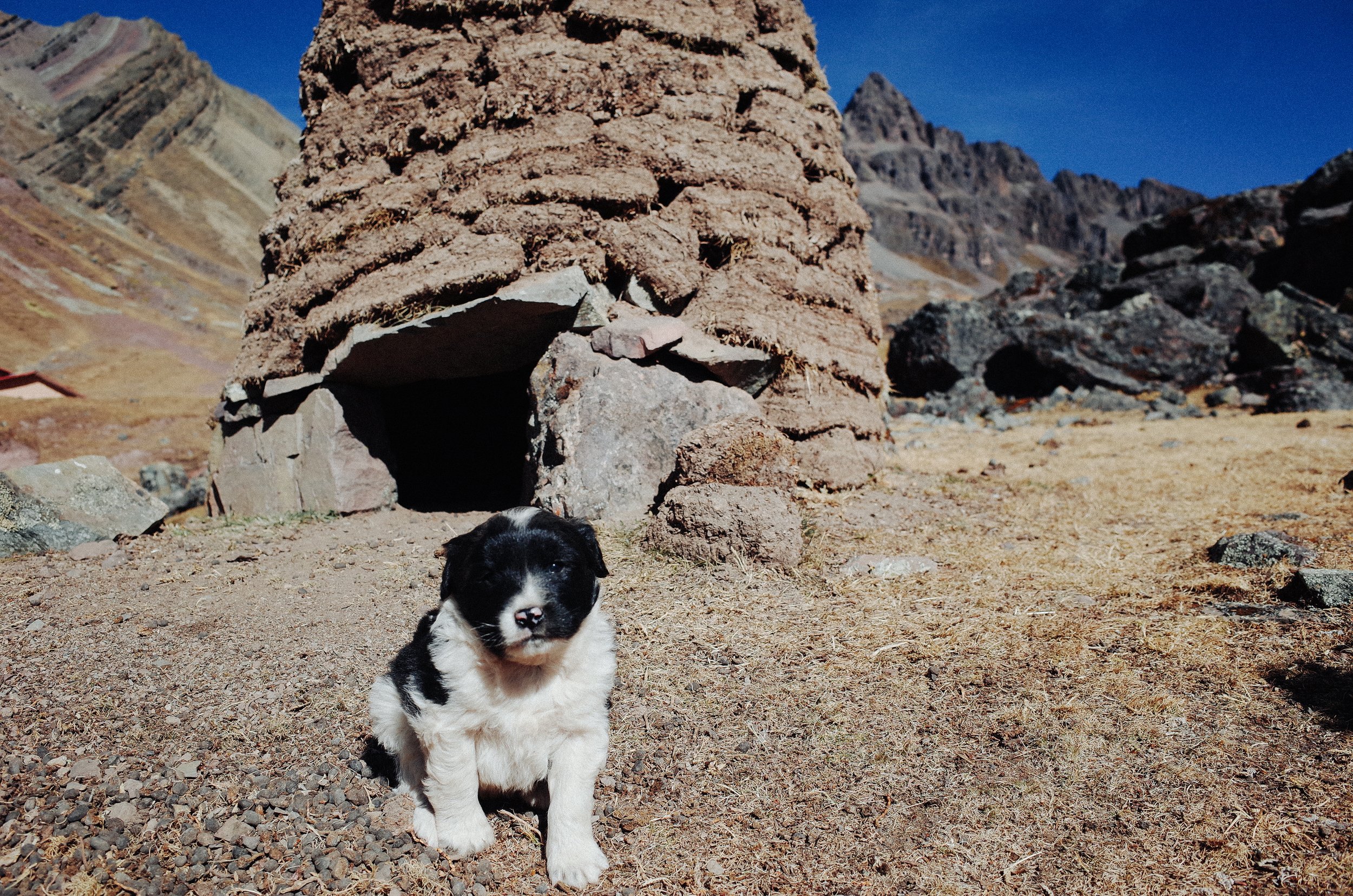
Cute alpacas
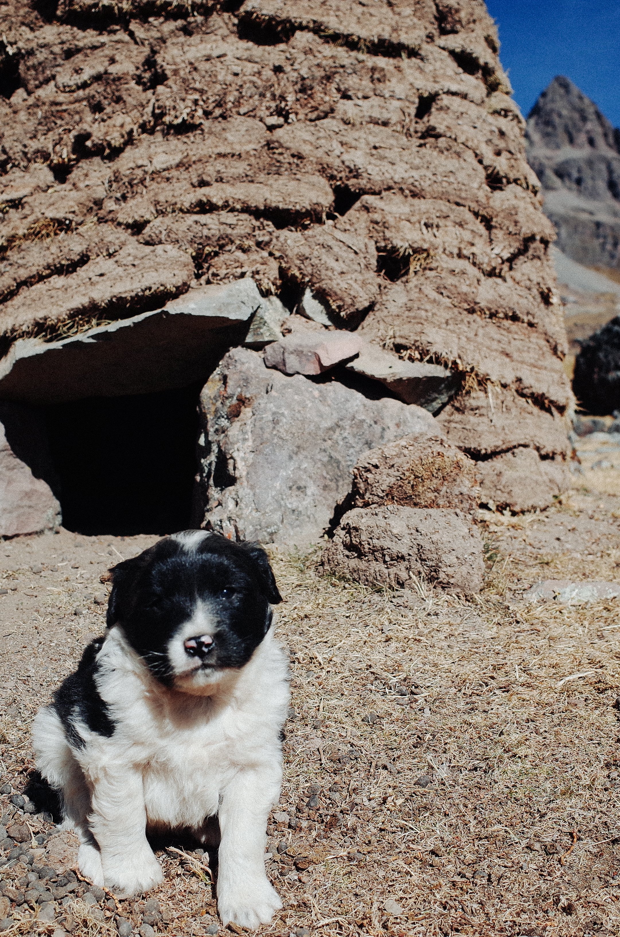
Friendly dogs
Observing shepherds weaving in the pasture
Getting dropped by traders crossing the landscape on foot in traditional dress
Learning about the methods of growing chuńo potatoes in the Ausangate Valley
Glorious Singletrack descents
Tips
This route is best-ridden (and more rideable) in the counter-clockwise direction.
Avoid camping directly next to streams. The temperatures can be extraordinarily colder near the streams at night.
This route is best done in the dry season: Late May to September, which is the wintertime. Water can freeze at night. A zero-degree Fahrenheit sleeping bag would be best.
Knowing Spanish will be very useful to your overall visit to Peru. However, your Spanish won't be as applicable on the Ausangate Circuit, where most people speak Quechua. Knowing a few words in Quechua and their proper pronunciation would be helpful so that you can communicate with the locals along the route, even if it's just Allianchu (pronounced: Eye-eee-anch-ooo), the word for "Hello, How are you?".
Chewing Coca leaves or drinking tea from the leaves helps soothe mild altitude sickness symptoms. Bring extra leaves to share with locals along the route.
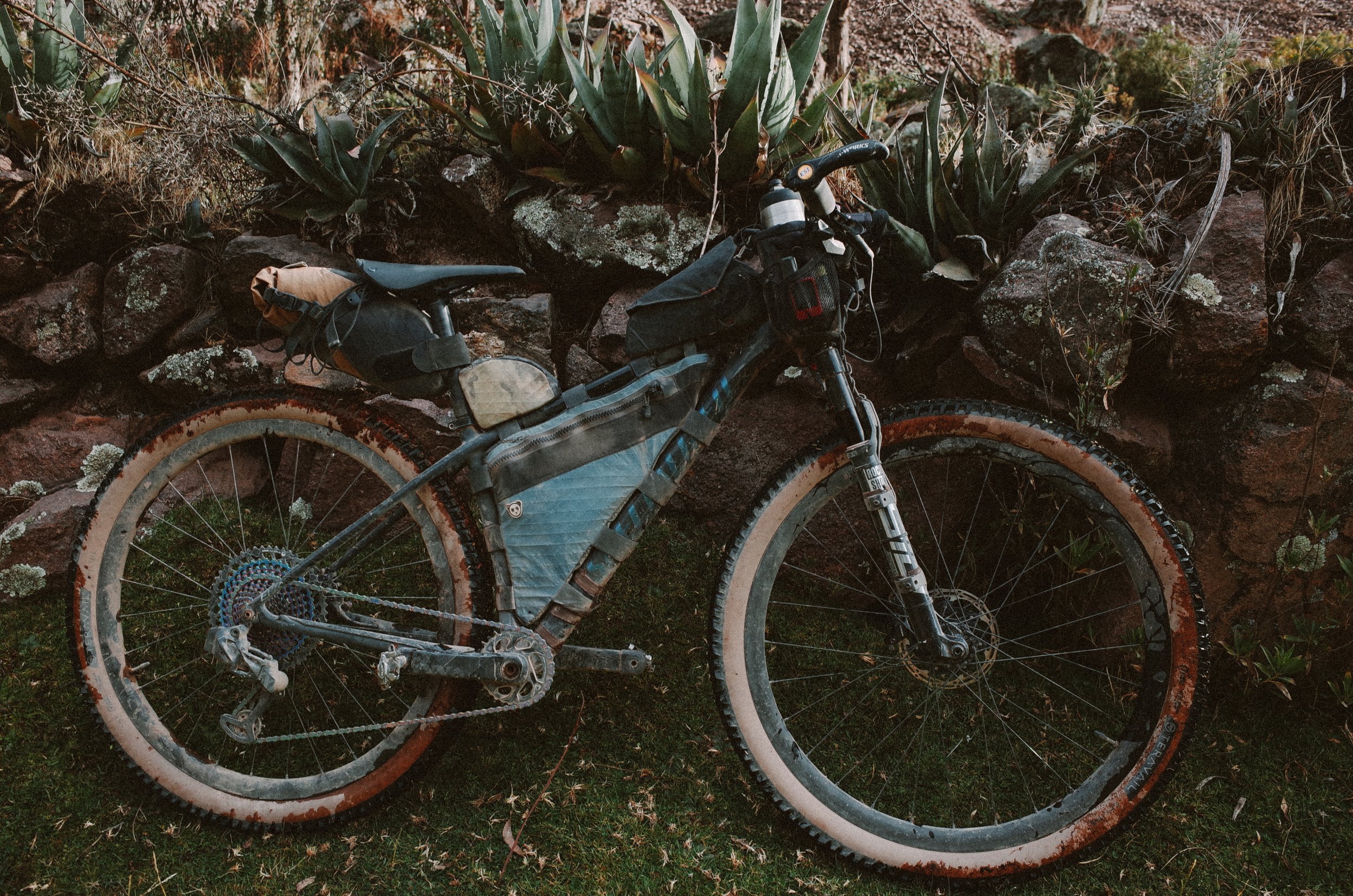
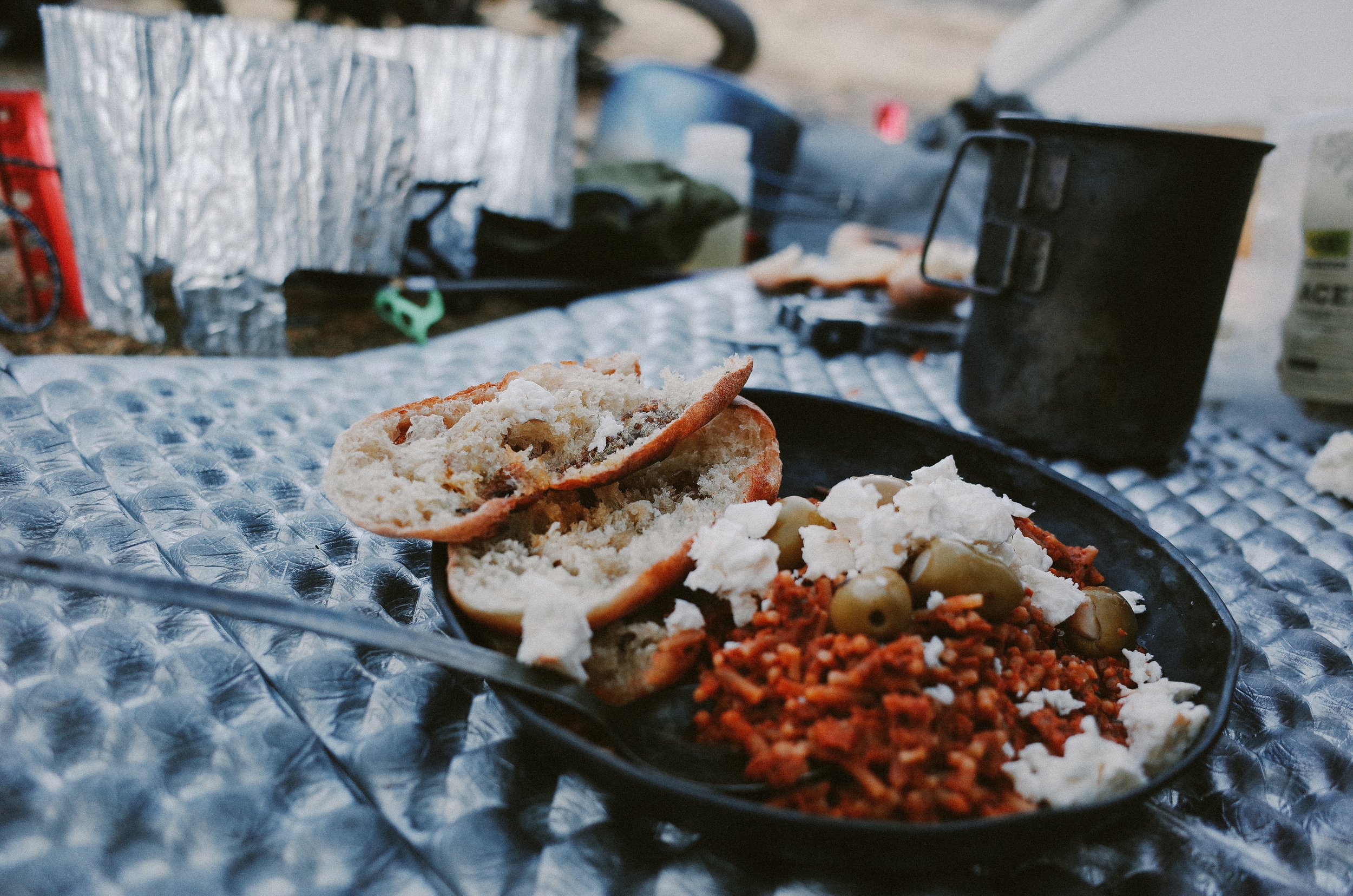
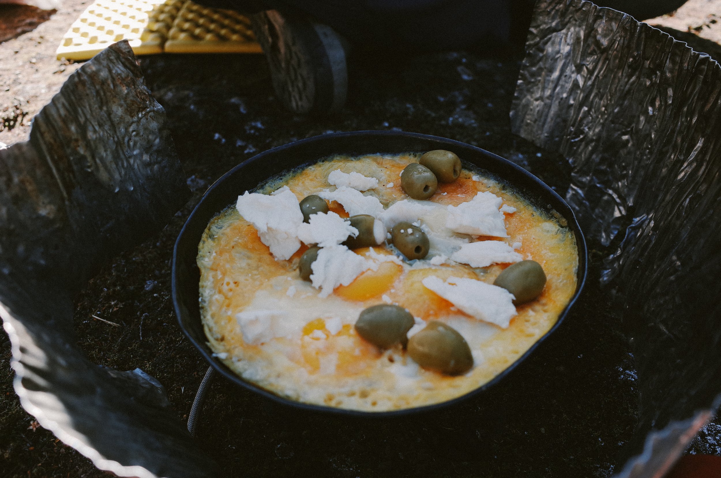
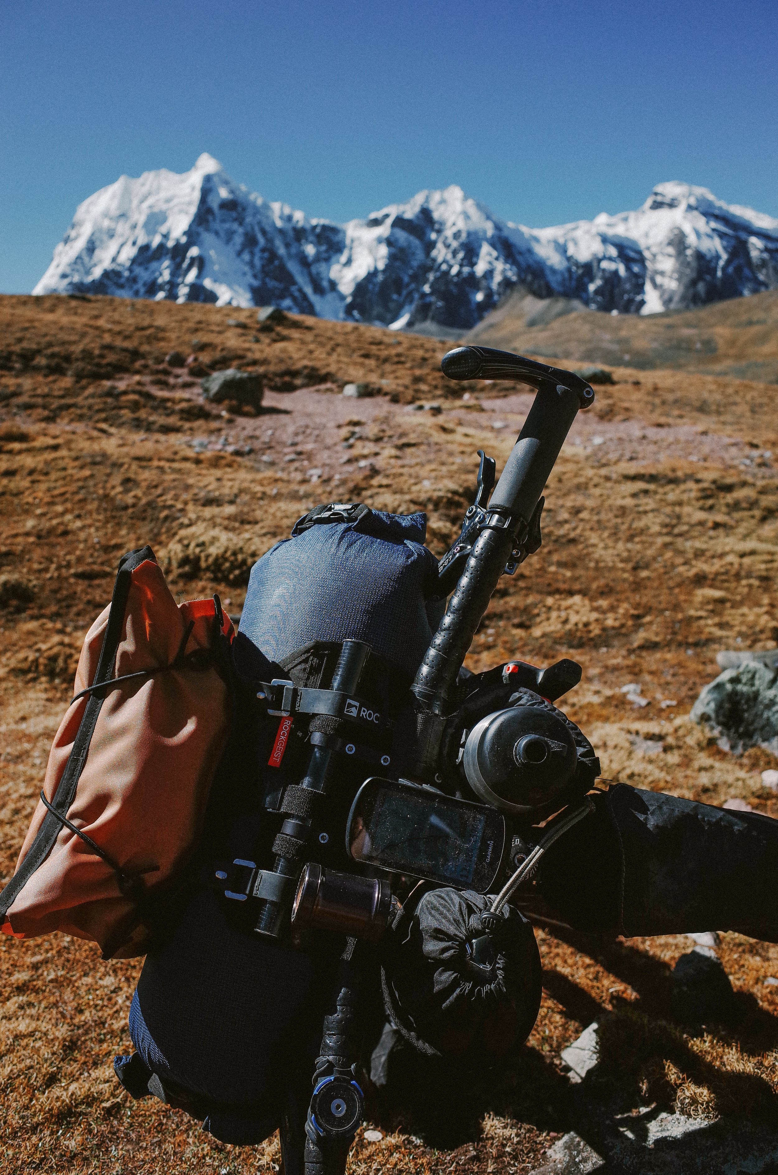
While this route (as we road it) requires that you carry up to 4-5 days' worth of food without resupply and cold weather gear, it is helpful to have as minimal set-up as possible due to the strenuous hike-a-bikes.
If you come from lower altitudes, spend 2-5 days acclimating in and around Cusco before heading to Pitumarca. There are loads of fun mountain bike trails just outside of the city. You can also hire a local guide to take you on a ride in the Sacred Valley.
Itinerary
The itinerary we followed uses all three routes: route to and from Ausangate from Pitumarca, Ausangate Circuit, and Rainbow Mountain Add-on. Our schedule was a casual and safe way to ride the Ausangate Circuit. It allowed time for us to sleep in until it was warm enough to leave our sleeping bags, cook a nice breakfast and do some stretching in the morning. Then, we would complete a portion of the route, including all the hike-a-biking, and get to camp an hour or more before it got dark (at which point it got frigid). We were on vacation, after all. We also acclimated very well following this itinerary. Use it as you see fit. Everybody is different, so follow what feels right for you.
Day one: Ride 12 miles from Pitumarca to Acclimatization Camp 13,000 ft.
Day two: Ride 22 miles. Camp in Chillca (14,200 ft)
Day three: Day off to acclimate in Chillca (14,200 ft)
Day Four: Ride 8 miles. Camp near Campamento (5,100 ft)
Day Five: Ride 9 miles (high pass 16,600 ft). Camp near Azul Cocha (15,000 ft)
Day Six: Ride 9.5 miles (high pass 15,600 ft) Camp near Campamento gratis (15,000)
Day Seven: Ride 12 miles (high pass 16,000 ft) Camp near Anantapa (15,380)
Day Eight: Ride 11 miles to Rainbow Mountain (high passes 16,200 and 16,300 ft) and 19 miles back to Pitumarca.
Resources
Peru: Ausangate Circuit and Rainbow Mountain by Mark Watson
La Ruta de las Tres Cordilleras by Michael Dammer
Ausangate Traverse, Peru by Cass Gilbert
A Goodbye to Peru through the Ausangate Circtuit by Ryan Wilson